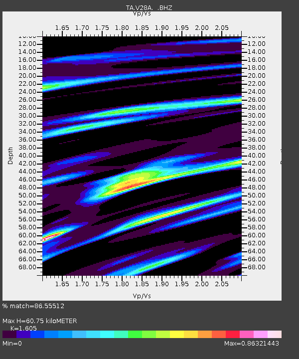
V28A Channing, TX, USA - Earthquake Result Viewer
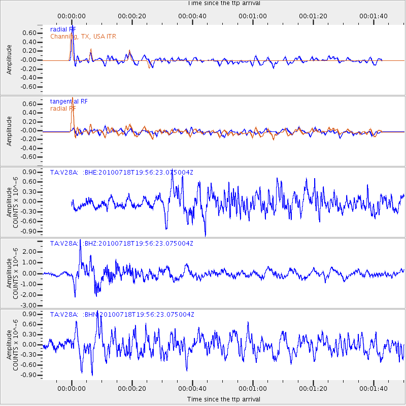
Earthquake location: Fox Islands, Aleutian Islands
Earthquake latitude/longitude: 52.8/-169.7
Earthquake time(UTC): 2010/07/18 (199) 19:48:04 GMT
Earthquake Depth: 10 km
Earthquake Magnitude: 5.6 MB, 5.6 MS, 6.0 MW, 6.0 MW
Earthquake Catalog/Contributor: WHDF/NEIC
Network: TA USArray Transportable Network (new EarthScope stations)
Station: V28A Channing, TX, USA
Lat/Lon: 35.75 N/102.22 W
Elevation: 1163 m
Distance: 49.4 deg
Az: 82.0 deg
Baz: 312.36 deg
Ray Param: 0.06874744
Estimated Moho Depth: 60.75 km
Estimated Crust Vp/Vs: 1.61
Assumed Crust Vp: 6.242 km/s
Estimated Crust Vs: 3.889 km/s
Estimated Crust Poisson's Ratio: 0.18
Radial Match: 86.55512 %
Radial Bump: 400
Transverse Match: 51.080048 %
Transverse Bump: 400
SOD ConfigId: 319893
Insert Time: 2011-01-05 07:20:11.669 +0000
GWidth: 2.5
Max Bumps: 400
Tol: 0.001

Signal To Noise

ChannelStoNSTALTA
TA:V28A: :BHZ:20100718T19:56:23.075004Z12.1478871.0655375E-68.7713815E-8
TA:V28A: :BHN:20100718T19:56:23.075004Z2.99152573.6247832E-71.2116838E-7
TA:V28A: :BHE:20100718T19:56:23.075004Z4.03771264.4755427E-71.1084352E-7
Arrivals
Ps6.3 SECOND
PpPs24 SECOND
PsPs/PpSs30 SECOND