
431A Sonora, TX, USA - Earthquake Result Viewer
| ||||||||||||||||||
| ||||||||||||||||||
| ||||||||||||||||||
|
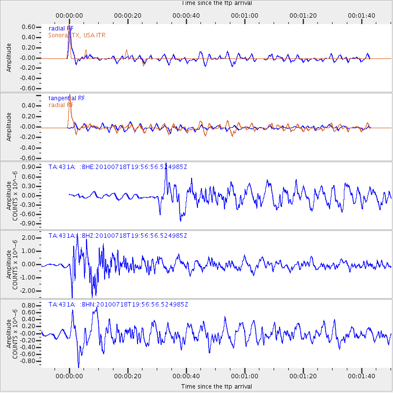
Signal To Noise
| Channel | StoN | STA | LTA |
| TA:431A: :BHZ:20100718T19:56:56.524985Z | 11.215785 | 1.0598418E-6 | 9.449555E-8 |
| TA:431A: :BHN:20100718T19:56:56.524985Z | 6.2804327 | 4.1978504E-7 | 6.6840144E-8 |
| TA:431A: :BHE:20100718T19:56:56.524985Z | 6.128823 | 3.619833E-7 | 5.906245E-8 |
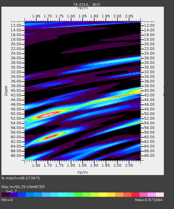
| Arrivals | |
| Ps | 5.8 SECOND |
| PpPs | 20 SECOND |
| PsPs/PpSs | 26 SECOND |

