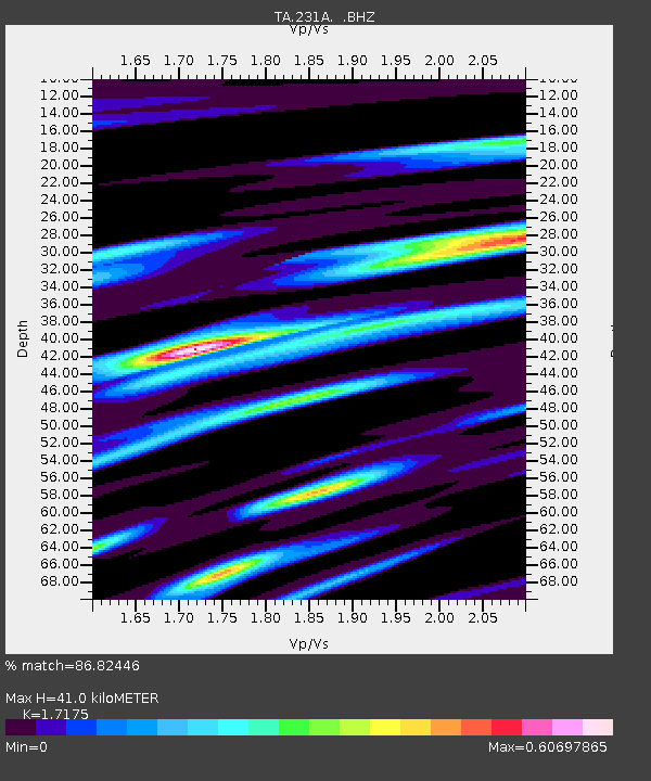
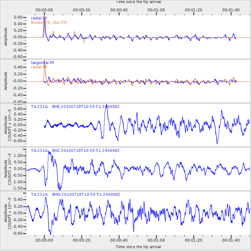
231A Bronte, TX, USA - Earthquake Result Viewer

Earthquake location: Fox Islands, Aleutian Islands
Earthquake latitude/longitude: 52.8/-169.7
Earthquake time(UTC): 2010/07/18 (199) 19:48:04 GMT
Earthquake Depth: 10 km
Earthquake Magnitude: 5.6 MB, 5.6 MS, 6.0 MW, 6.0 MW
Earthquake Catalog/Contributor: WHDF/NEIC
Network: TA USArray Transportable Network (new EarthScope stations)
Station: 231A Bronte, TX, USA
Lat/Lon: 31.94 N/100.32 W
Elevation: 574 m
Distance: 53.1 deg
Az: 84.132 deg
Baz: 314.754 deg
Ray Param: 0.066301554
Estimated Moho Depth: 41.0 km
Estimated Crust Vp/Vs: 1.72
Assumed Crust Vp: 6.38 km/s
Estimated Crust Vs: 3.715 km/s
Estimated Crust Poisson's Ratio: 0.24
Radial Match: 86.82446 %
Radial Bump: 400
Transverse Match: 67.04483 %
Transverse Bump: 400
SOD ConfigId: 319893
Insert Time: 2011-01-05 07:22:25.257 +0000
GWidth: 2.5
Max Bumps: 400
Tol: 0.001

Signal To Noise

ChannelStoNSTALTA
TA:231A: :BHZ:20100718T19:56:51.349998Z9.765738.7590445E-78.969165E-8
TA:231A: :BHN:20100718T19:56:51.349998Z2.68314813.4767652E-71.2957783E-7
TA:231A: :BHE:20100718T19:56:51.349998Z7.26399764.047967E-75.572644E-8
Arrivals
Ps4.9 SECOND
PpPs17 SECOND
PsPs/PpSs21 SECOND