331A San Angelo, TX, USA - Earthquake Result Viewer
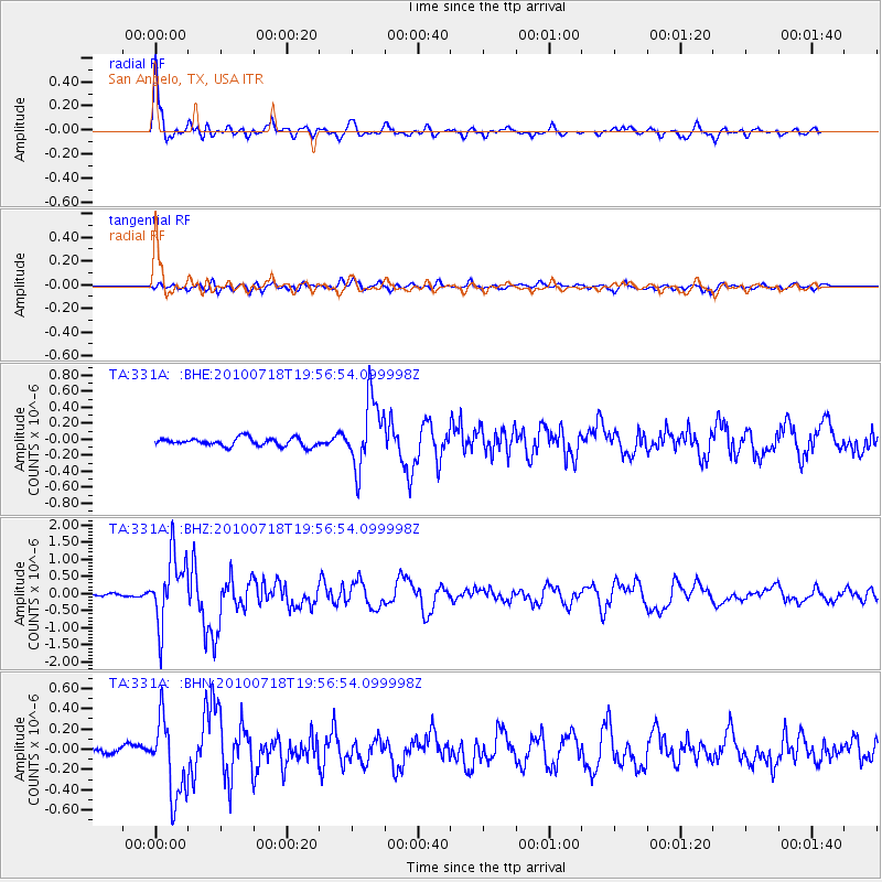
Earthquake location: Fox Islands, Aleutian Islands
Earthquake latitude/longitude: 52.8/-169.7
Earthquake time(UTC): 2010/07/18 (199) 19:48:04 GMT
Earthquake Depth: 10 km
Earthquake Magnitude: 5.6 MB, 5.6 MS, 6.0 MW, 6.0 MW
Earthquake Catalog/Contributor: WHDF/NEIC
Network: TA USArray Transportable Network (new EarthScope stations)
Station: 331A San Angelo, TX, USA
Lat/Lon: 31.31 N/100.43 W
Elevation: 615 m
Distance: 53.5 deg
Az: 84.767 deg
Baz: 315.075 deg
Ray Param: 0.06605039
Estimated Moho Depth: 40.25 km
Estimated Crust Vp/Vs: 1.97
Assumed Crust Vp: 6.38 km/s
Estimated Crust Vs: 3.243 km/s
Estimated Crust Poisson's Ratio: 0.33
Radial Match: 88.66882 %
Radial Bump: 400
Transverse Match: 63.67883 %
Transverse Bump: 400
SOD ConfigId: 319893
Insert Time: 2011-01-05 07:22:44.868 +0000
GWidth: 2.5
Max Bumps: 400
Tol: 0.001

Signal To Noise

ChannelStoNSTALTA
TA:331A: :BHZ:20100718T19:56:54.099998Z18.4542929.950172E-75.3917926E-8
TA:331A: :BHN:20100718T19:56:54.099998Z4.9123833.8019576E-77.739538E-8
TA:331A: :BHE:20100718T19:56:54.099998Z8.499184.2946854E-75.0530588E-8
Arrivals
Ps6.4 SECOND
PpPs18 SECOND
PsPs/PpSs24 SECOND