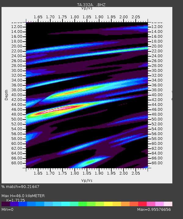
332A Millersview, TX, USA - Earthquake Result Viewer
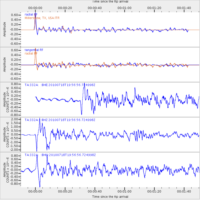
Earthquake location: Fox Islands, Aleutian Islands
Earthquake latitude/longitude: 52.8/-169.7
Earthquake time(UTC): 2010/07/18 (199) 19:48:04 GMT
Earthquake Depth: 10 km
Earthquake Magnitude: 5.6 MB, 5.6 MS, 6.0 MW, 6.0 MW
Earthquake Catalog/Contributor: WHDF/NEIC
Network: TA USArray Transportable Network (new EarthScope stations)
Station: 332A Millersview, TX, USA
Lat/Lon: 31.38 N/99.74 W
Elevation: 513 m
Distance: 53.9 deg
Az: 84.187 deg
Baz: 315.086 deg
Ray Param: 0.065808386
Estimated Moho Depth: 46.0 km
Estimated Crust Vp/Vs: 1.71
Assumed Crust Vp: 6.498 km/s
Estimated Crust Vs: 3.794 km/s
Estimated Crust Poisson's Ratio: 0.24
Radial Match: 90.21647 %
Radial Bump: 400
Transverse Match: 76.26009 %
Transverse Bump: 400
SOD ConfigId: 319893
Insert Time: 2011-01-05 07:22:49.744 +0000
GWidth: 2.5
Max Bumps: 400
Tol: 0.001

Signal To Noise

ChannelStoNSTALTA
TA:332A: :BHZ:20100718T19:56:56.724998Z26.3800681.0204099E-63.868109E-8
TA:332A: :BHN:20100718T19:56:56.724998Z6.92946054.4404774E-76.408114E-8
TA:332A: :BHE:20100718T19:56:56.724998Z7.44821074.049114E-75.436358E-8
Arrivals
Ps5.3 SECOND
PpPs18 SECOND
PsPs/PpSs23 SECOND