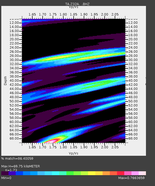
Z32A Haskell, TX, USA - Earthquake Result Viewer
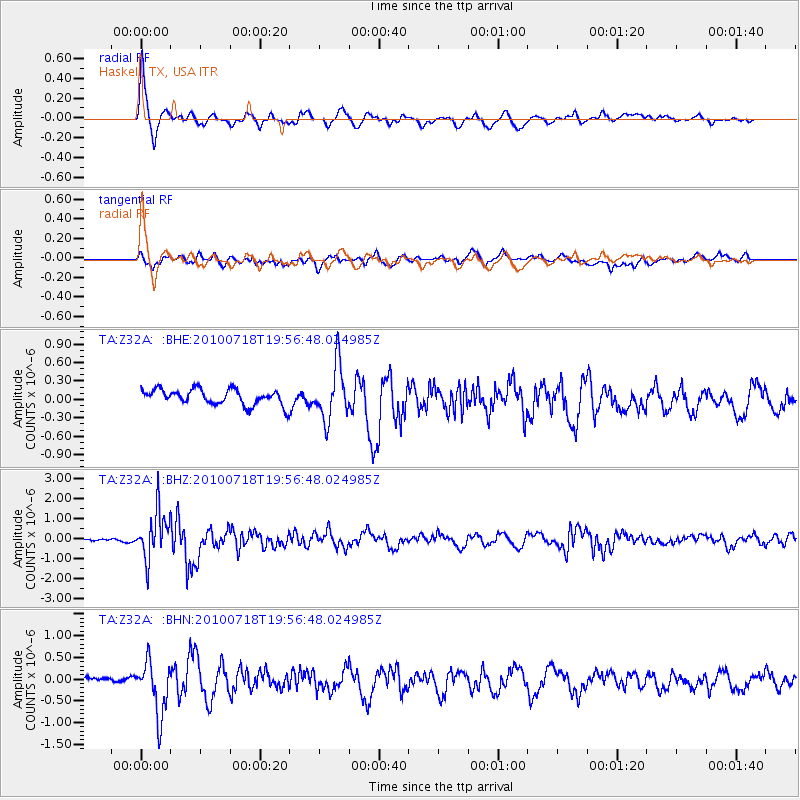
Earthquake location: Fox Islands, Aleutian Islands
Earthquake latitude/longitude: 52.8/-169.7
Earthquake time(UTC): 2010/07/18 (199) 19:48:04 GMT
Earthquake Depth: 10 km
Earthquake Magnitude: 5.6 MB, 5.6 MS, 6.0 MW, 6.0 MW
Earthquake Catalog/Contributor: WHDF/NEIC
Network: TA USArray Transportable Network (new EarthScope stations)
Station: Z32A Haskell, TX, USA
Lat/Lon: 33.31 N/99.48 W
Elevation: 427 m
Distance: 52.7 deg
Az: 82.287 deg
Baz: 314.091 deg
Ray Param: 0.06660121
Estimated Moho Depth: 69.75 km
Estimated Crust Vp/Vs: 1.73
Assumed Crust Vp: 6.426 km/s
Estimated Crust Vs: 3.715 km/s
Estimated Crust Poisson's Ratio: 0.25
Radial Match: 86.40059 %
Radial Bump: 400
Transverse Match: 66.78425 %
Transverse Bump: 400
SOD ConfigId: 319893
Insert Time: 2011-01-05 07:23:02.027 +0000
GWidth: 2.5
Max Bumps: 400
Tol: 0.001

Signal To Noise

ChannelStoNSTALTA
TA:Z32A: :BHZ:20100718T19:56:48.024985Z15.4893161.1738932E-67.5787284E-8
TA:Z32A: :BHN:20100718T19:56:48.024985Z7.8052886.1413857E-77.868237E-8
TA:Z32A: :BHE:20100718T19:56:48.024985Z3.45896434.3748858E-71.2647965E-7
Arrivals
Ps8.4 SECOND
PpPs28 SECOND
PsPs/PpSs36 SECOND