R30A Dighton, KS, USA - Earthquake Result Viewer
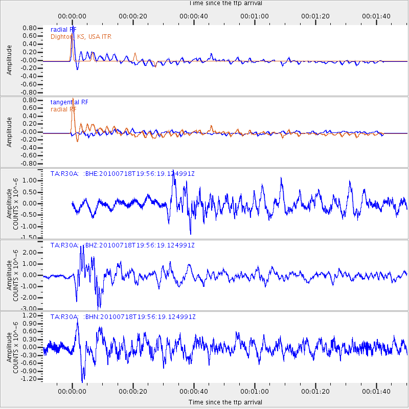
Earthquake location: Fox Islands, Aleutian Islands
Earthquake latitude/longitude: 52.8/-169.7
Earthquake time(UTC): 2010/07/18 (199) 19:48:04 GMT
Earthquake Depth: 10 km
Earthquake Magnitude: 5.6 MB, 5.6 MS, 6.0 MW, 6.0 MW
Earthquake Catalog/Contributor: WHDF/NEIC
Network: TA USArray Transportable Network (new EarthScope stations)
Station: R30A Dighton, KS, USA
Lat/Lon: 38.28 N/100.28 W
Elevation: 776 m
Distance: 48.8 deg
Az: 78.13 deg
Baz: 310.994 deg
Ray Param: 0.06908907
Estimated Moho Depth: 40.75 km
Estimated Crust Vp/Vs: 1.99
Assumed Crust Vp: 6.483 km/s
Estimated Crust Vs: 3.258 km/s
Estimated Crust Poisson's Ratio: 0.33
Radial Match: 88.20922 %
Radial Bump: 400
Transverse Match: 55.62506 %
Transverse Bump: 400
SOD ConfigId: 319893
Insert Time: 2011-01-05 07:25:14.255 +0000
GWidth: 2.5
Max Bumps: 400
Tol: 0.001

Signal To Noise

ChannelStoNSTALTA
TA:R30A: :BHZ:20100718T19:56:19.124991Z9.33770751.1203624E-61.199826E-7
TA:R30A: :BHN:20100718T19:56:19.124991Z4.18728166.105853E-71.4581902E-7
TA:R30A: :BHE:20100718T19:56:19.124991Z3.158275.911431E-71.8717307E-7
Arrivals
Ps6.6 SECOND
PpPs18 SECOND
PsPs/PpSs24 SECOND