
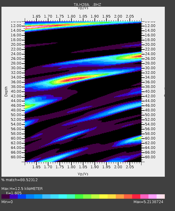
H28A Mission Ridge, SD, USA - Earthquake Result Viewer
| ||||||||||||||||||
| ||||||||||||||||||
| ||||||||||||||||||
|
Signal To Noise
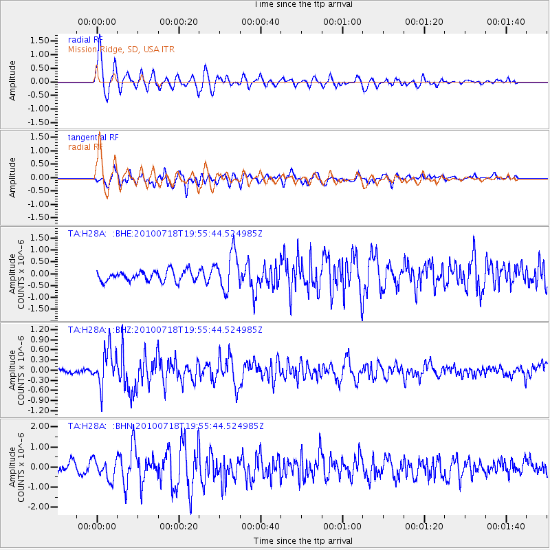
| Channel | StoN | STA | LTA |
| TA:H28A: :BHZ:20100718T19:55:44.524985Z | 11.202321 | 5.63584E-7 | 5.0309577E-8 |
| TA:H28A: :BHN:20100718T19:55:44.524985Z | 2.337636 | 5.0281255E-7 | 2.1509445E-7 |
| TA:H28A: :BHE:20100718T19:55:44.524985Z | 3.7847342 | 8.182749E-7 | 2.1620406E-7 |
| Arrivals | |
| Ps | 1.2 SECOND |
| PpPs | 4.6 SECOND |
| PsPs/PpSs | 5.9 SECOND |

