You are here: Home > Network List > TA - USArray Transportable Network (new EarthScope stations) Stations List
> Station C26A Wahner Farm, Parshall, ND, USA > Earthquake Result Viewer
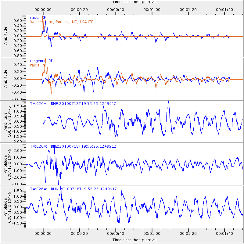
C26A Wahner Farm, Parshall, ND, USA - Earthquake Result Viewer
*The percent match for this event was below the threshold and hence no stack was calculated.
| Earthquake location: |
Fox Islands, Aleutian Islands |
| Earthquake latitude/longitude: |
52.8/-169.7 |
| Earthquake time(UTC): |
2010/07/18 (199) 19:48:04 GMT |
| Earthquake Depth: |
10 km |
| Earthquake Magnitude: |
5.6 MB, 5.6 MS, 6.0 MW, 6.0 MW |
| Earthquake Catalog/Contributor: |
WHDF/NEIC |
|
| Network: |
TA USArray Transportable Network (new EarthScope stations) |
| Station: |
C26A Wahner Farm, Parshall, ND, USA |
| Lat/Lon: |
47.83 N/102.10 W |
| Elevation: |
656 m |
|
| Distance: |
42.0 deg |
| Az: |
68.569 deg |
| Baz: |
303.023 deg |
| Ray Param: |
$rayparam |
*The percent match for this event was below the threshold and hence was not used in the summary stack. |
|
| Radial Match: |
79.230194 % |
| Radial Bump: |
350 |
| Transverse Match: |
66.70995 % |
| Transverse Bump: |
386 |
| SOD ConfigId: |
319893 |
| Insert Time: |
2011-01-05 07:28:39.693 +0000 |
| GWidth: |
2.5 |
| Max Bumps: |
400 |
| Tol: |
0.001 |
|
Signal To Noise
| Channel | StoN | STA | LTA |
| TA:C26A: :BHZ:20100718T19:55:25.124991Z | 7.326692 | 1.2168999E-6 | 1.6609131E-7 |
| TA:C26A: :BHN:20100718T19:55:25.124991Z | 1.6518584 | 5.23756E-7 | 3.1707074E-7 |
| TA:C26A: :BHE:20100718T19:55:25.124991Z | 2.3405082 | 8.818508E-7 | 3.7677748E-7 |
| Arrivals |
| Ps | |
| PpPs | |
| PsPs/PpSs | |


