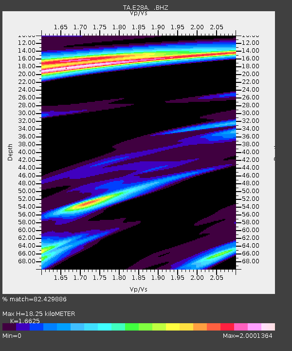
E28A Huff, ND, USA - Earthquake Result Viewer

Earthquake location: Fox Islands, Aleutian Islands
Earthquake latitude/longitude: 52.8/-169.7
Earthquake time(UTC): 2010/07/18 (199) 19:48:04 GMT
Earthquake Depth: 10 km
Earthquake Magnitude: 5.6 MB, 5.6 MS, 6.0 MW, 6.0 MW
Earthquake Catalog/Contributor: WHDF/NEIC
Network: TA USArray Transportable Network (new EarthScope stations)
Station: E28A Huff, ND, USA
Lat/Lon: 46.57 N/100.69 W
Elevation: 579 m
Distance: 43.5 deg
Az: 69.317 deg
Baz: 304.598 deg
Ray Param: 0.07250498
Estimated Moho Depth: 18.25 km
Estimated Crust Vp/Vs: 1.66
Assumed Crust Vp: 6.438 km/s
Estimated Crust Vs: 3.872 km/s
Estimated Crust Poisson's Ratio: 0.22
Radial Match: 82.429886 %
Radial Bump: 400
Transverse Match: 66.464714 %
Transverse Bump: 400
SOD ConfigId: 319893
Insert Time: 2011-01-05 07:29:41.046 +0000
GWidth: 2.5
Max Bumps: 400
Tol: 0.001

Signal To Noise

ChannelStoNSTALTA
TA:E28A: :BHZ:20100718T19:55:37.200004Z11.0605871.2389105E-61.12011286E-7
TA:E28A: :BHN:20100718T19:55:37.200004Z1.61207275.3722385E-73.332504E-7
TA:E28A: :BHE:20100718T19:55:37.200004Z1.1227625.63903E-75.022462E-7
Arrivals
Ps2.0 SECOND
PpPs7.0 SECOND
PsPs/PpSs9.0 SECOND