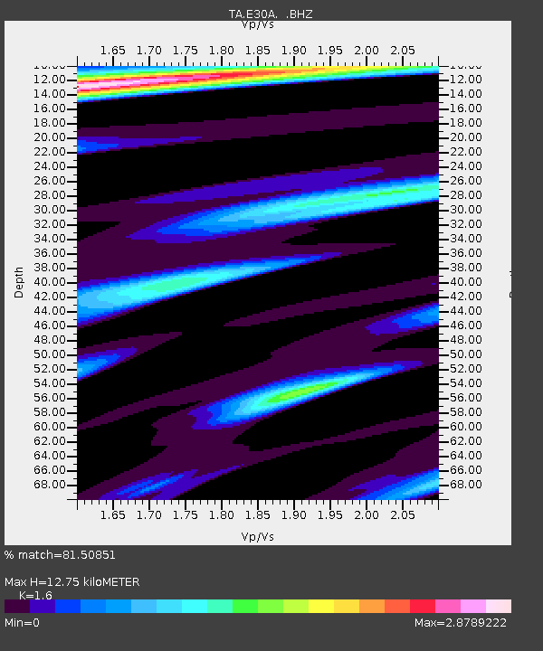
E30A Jud, ND, USA - Earthquake Result Viewer
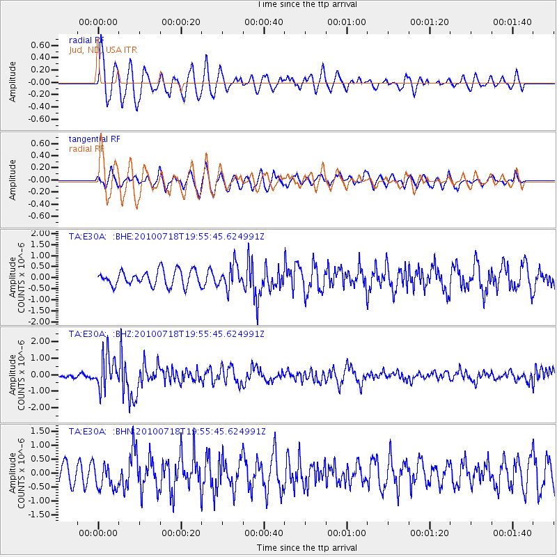
Earthquake location: Fox Islands, Aleutian Islands
Earthquake latitude/longitude: 52.8/-169.7
Earthquake time(UTC): 2010/07/18 (199) 19:48:04 GMT
Earthquake Depth: 10 km
Earthquake Magnitude: 5.6 MB, 5.6 MS, 6.0 MW, 6.0 MW
Earthquake Catalog/Contributor: WHDF/NEIC
Network: TA USArray Transportable Network (new EarthScope stations)
Station: E30A Jud, ND, USA
Lat/Lon: 46.50 N/98.91 W
Elevation: 544 m
Distance: 44.6 deg
Az: 68.389 deg
Baz: 305.221 deg
Ray Param: 0.071839444
Estimated Moho Depth: 12.75 km
Estimated Crust Vp/Vs: 1.60
Assumed Crust Vp: 6.53 km/s
Estimated Crust Vs: 4.082 km/s
Estimated Crust Poisson's Ratio: 0.18
Radial Match: 81.50851 %
Radial Bump: 400
Transverse Match: 50.868053 %
Transverse Bump: 400
SOD ConfigId: 319893
Insert Time: 2011-01-05 07:30:16.169 +0000
GWidth: 2.5
Max Bumps: 400
Tol: 0.001

Signal To Noise

ChannelStoNSTALTA
TA:E30A: :BHZ:20100718T19:55:45.624991Z8.7872431.0288819E-61.17088135E-7
TA:E30A: :BHN:20100718T19:55:45.624991Z0.9574664.8506973E-75.066183E-7
TA:E30A: :BHE:20100718T19:55:45.624991Z1.51784945.197929E-73.4245355E-7
Arrivals
Ps1.3 SECOND
PpPs4.7 SECOND
PsPs/PpSs6.0 SECOND