You are here: Home > Network List > US - United States National Seismic Network Stations List
> Station AGMN Agassiz National Wildlife Refuge, Minnesota, USA > Earthquake Result Viewer
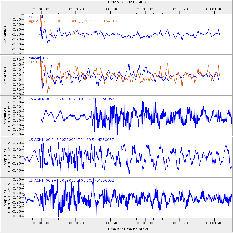
AGMN Agassiz National Wildlife Refuge, Minnesota, USA - Earthquake Result Viewer
*The percent match for this event was below the threshold and hence no stack was calculated.
| Earthquake location: |
Alaska Peninsula |
| Earthquake latitude/longitude: |
54.9/-160.3 |
| Earthquake time(UTC): |
2023/09/21 (264) 01:13:58 GMT |
| Earthquake Depth: |
24 km |
| Earthquake Magnitude: |
5.5 ml |
| Earthquake Catalog/Contributor: |
NEIC PDE/ak |
|
| Network: |
US United States National Seismic Network |
| Station: |
AGMN Agassiz National Wildlife Refuge, Minnesota, USA |
| Lat/Lon: |
48.30 N/95.86 W |
| Elevation: |
351 m |
|
| Distance: |
39.3 deg |
| Az: |
72.054 deg |
| Baz: |
304.602 deg |
| Ray Param: |
$rayparam |
*The percent match for this event was below the threshold and hence was not used in the summary stack. |
|
| Radial Match: |
45.40488 % |
| Radial Bump: |
400 |
| Transverse Match: |
49.609776 % |
| Transverse Bump: |
400 |
| SOD ConfigId: |
31937991 |
| Insert Time: |
2023-10-05 01:33:42.918 +0000 |
| GWidth: |
2.5 |
| Max Bumps: |
400 |
| Tol: |
0.001 |
|
Signal To Noise
| Channel | StoN | STA | LTA |
| US:AGMN:00:BHZ:20230921T01:20:54.425005Z | 2.2382598 | 2.31041E-7 | 1.032235E-7 |
| US:AGMN:00:BH1:20230921T01:20:54.425005Z | 1.8596963 | 2.8692722E-7 | 1.5428715E-7 |
| US:AGMN:00:BH2:20230921T01:20:54.425005Z | 2.7484605 | 3.4005882E-7 | 1.2372702E-7 |
| Arrivals |
| Ps | |
| PpPs | |
| PsPs/PpSs | |


