
N02D Trinity Center, CA, USA - Earthquake Result Viewer
| ||||||||||||||||||
| ||||||||||||||||||
| ||||||||||||||||||
|
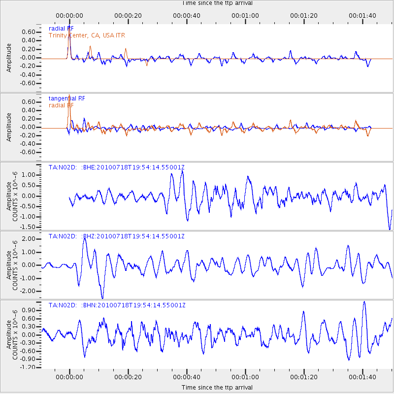
Signal To Noise
| Channel | StoN | STA | LTA |
| TA:N02D: :BHZ:20100718T19:54:14.55001Z | 4.152416 | 7.408104E-7 | 1.7840465E-7 |
| TA:N02D: :BHN:20100718T19:54:14.55001Z | 1.472768 | 2.6933097E-7 | 1.8287399E-7 |
| TA:N02D: :BHE:20100718T19:54:14.55001Z | 2.3880448 | 4.2006357E-7 | 1.7590271E-7 |
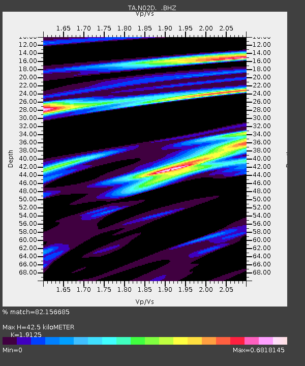
| Arrivals | |
| Ps | 6.4 SECOND |
| PpPs | 17 SECOND |
| PsPs/PpSs | 24 SECOND |

