534A Blanco, TX, USA - Earthquake Result Viewer
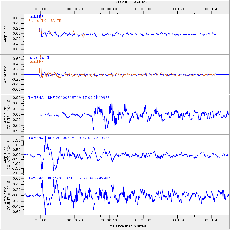
Earthquake location: Fox Islands, Aleutian Islands
Earthquake latitude/longitude: 52.8/-169.7
Earthquake time(UTC): 2010/07/18 (199) 19:48:04 GMT
Earthquake Depth: 10 km
Earthquake Magnitude: 5.6 MB, 5.6 MS, 6.0 MW, 6.0 MW
Earthquake Catalog/Contributor: WHDF/NEIC
Network: TA USArray Transportable Network (new EarthScope stations)
Station: 534A Blanco, TX, USA
Lat/Lon: 30.03 N/98.48 W
Elevation: 461 m
Distance: 55.6 deg
Az: 84.394 deg
Baz: 315.85 deg
Ray Param: 0.06468729
Estimated Moho Depth: 21.75 km
Estimated Crust Vp/Vs: 1.69
Assumed Crust Vp: 6.498 km/s
Estimated Crust Vs: 3.839 km/s
Estimated Crust Poisson's Ratio: 0.23
Radial Match: 92.5692 %
Radial Bump: 400
Transverse Match: 74.36627 %
Transverse Bump: 400
SOD ConfigId: 319893
Insert Time: 2011-01-05 07:35:02.086 +0000
GWidth: 2.5
Max Bumps: 400
Tol: 0.001

Signal To Noise

ChannelStoNSTALTA
TA:534A: :BHZ:20100718T19:57:09.224998Z16.9147999.552053E-75.6471574E-8
TA:534A: :BHN:20100718T19:57:09.224998Z8.2525293.058792E-73.7064908E-8
TA:534A: :BHE:20100718T19:57:09.224998Z7.28918034.349288E-75.966773E-8
Arrivals
Ps2.5 SECOND
PpPs8.5 SECOND
PsPs/PpSs11 SECOND