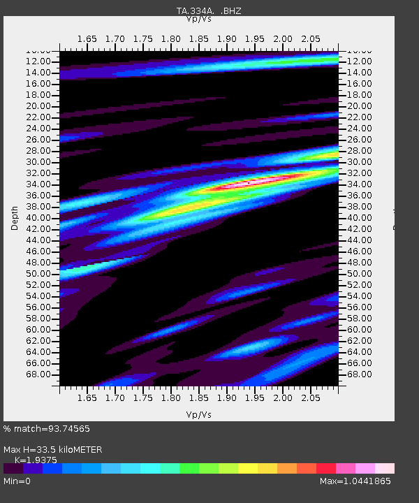
334A Lometa, TX, USA - Earthquake Result Viewer
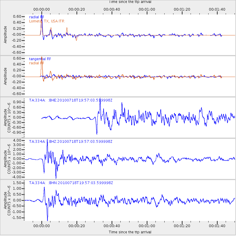
Earthquake location: Fox Islands, Aleutian Islands
Earthquake latitude/longitude: 52.8/-169.7
Earthquake time(UTC): 2010/07/18 (199) 19:48:04 GMT
Earthquake Depth: 10 km
Earthquake Magnitude: 5.6 MB, 5.6 MS, 6.0 MW, 6.0 MW
Earthquake Catalog/Contributor: WHDF/NEIC
Network: TA USArray Transportable Network (new EarthScope stations)
Station: 334A Lometa, TX, USA
Lat/Lon: 31.33 N/98.24 W
Elevation: 389 m
Distance: 54.8 deg
Az: 83.108 deg
Baz: 315.236 deg
Ray Param: 0.06520703
Estimated Moho Depth: 33.5 km
Estimated Crust Vp/Vs: 1.94
Assumed Crust Vp: 6.498 km/s
Estimated Crust Vs: 3.354 km/s
Estimated Crust Poisson's Ratio: 0.32
Radial Match: 93.74565 %
Radial Bump: 400
Transverse Match: 72.70346 %
Transverse Bump: 400
SOD ConfigId: 319893
Insert Time: 2011-01-05 07:36:16.647 +0000
GWidth: 2.5
Max Bumps: 400
Tol: 0.001

Signal To Noise

ChannelStoNSTALTA
TA:334A: :BHZ:20100718T19:57:03.599998Z21.3869111.4654115E-66.8519086E-8
TA:334A: :BHN:20100718T19:57:03.599998Z10.3882345.94391E-75.721771E-8
TA:334A: :BHE:20100718T19:57:03.599998Z8.1915754.331325E-75.287536E-8
Arrivals
Ps5.1 SECOND
PpPs14 SECOND
PsPs/PpSs19 SECOND