535A Dale, TX, USA - Earthquake Result Viewer
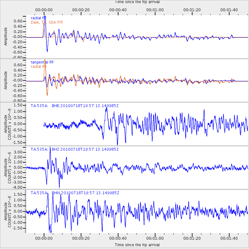
Earthquake location: Fox Islands, Aleutian Islands
Earthquake latitude/longitude: 52.8/-169.7
Earthquake time(UTC): 2010/07/18 (199) 19:48:04 GMT
Earthquake Depth: 10 km
Earthquake Magnitude: 5.6 MB, 5.6 MS, 6.0 MW, 6.0 MW
Earthquake Catalog/Contributor: WHDF/NEIC
Network: TA USArray Transportable Network (new EarthScope stations)
Station: 535A Dale, TX, USA
Lat/Lon: 30.03 N/97.57 W
Elevation: 170 m
Distance: 56.1 deg
Az: 83.713 deg
Baz: 315.918 deg
Ray Param: 0.06433209
Estimated Moho Depth: 38.75 km
Estimated Crust Vp/Vs: 1.77
Assumed Crust Vp: 6.347 km/s
Estimated Crust Vs: 3.586 km/s
Estimated Crust Poisson's Ratio: 0.27
Radial Match: 84.99392 %
Radial Bump: 400
Transverse Match: 72.425 %
Transverse Bump: 400
SOD ConfigId: 319893
Insert Time: 2011-01-05 07:37:32.261 +0000
GWidth: 2.5
Max Bumps: 400
Tol: 0.001

Signal To Noise

ChannelStoNSTALTA
TA:535A: :BHZ:20100718T19:57:13.149985Z15.9915691.5393985E-69.626313E-8
TA:535A: :BHN:20100718T19:57:13.149985Z4.93963241.011508E-62.0477394E-7
TA:535A: :BHE:20100718T19:57:13.149985Z4.5424626.9409225E-71.528009E-7
Arrivals
Ps4.9 SECOND
PpPs16 SECOND
PsPs/PpSs21 SECOND