
239A Gary, TX, USA - Earthquake Result Viewer
| ||||||||||||||||||
| ||||||||||||||||||
| ||||||||||||||||||
|
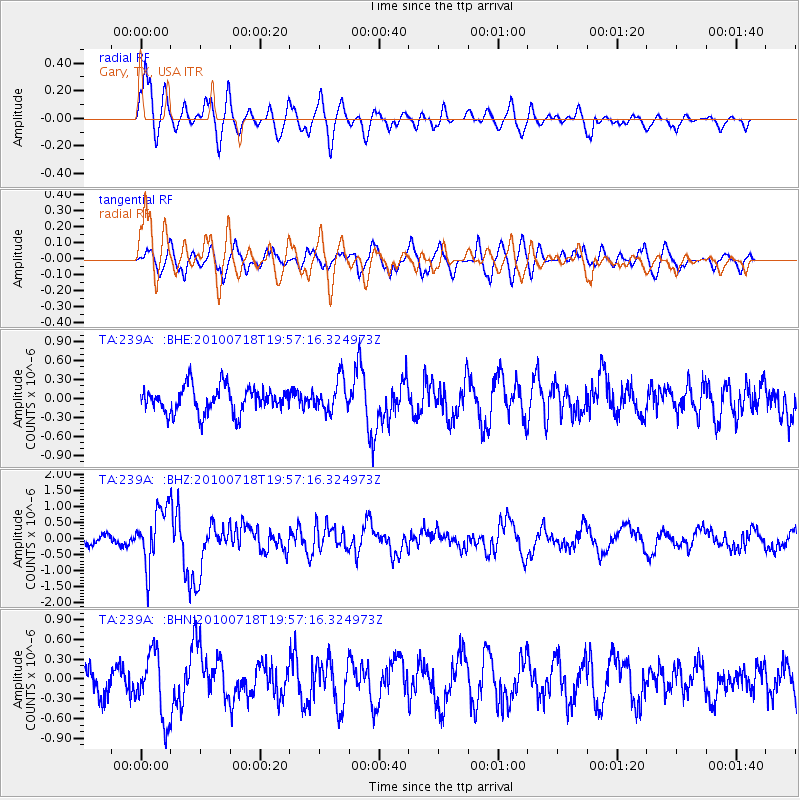
Signal To Noise
| Channel | StoN | STA | LTA |
| TA:239A: :BHZ:20100718T19:57:16.324973Z | 6.351814 | 8.767281E-7 | 1.3802799E-7 |
| TA:239A: :BHN:20100718T19:57:16.324973Z | 3.295045 | 4.986257E-7 | 1.5132592E-7 |
| TA:239A: :BHE:20100718T19:57:16.324973Z | 1.2159226 | 2.5047362E-7 | 2.0599471E-7 |
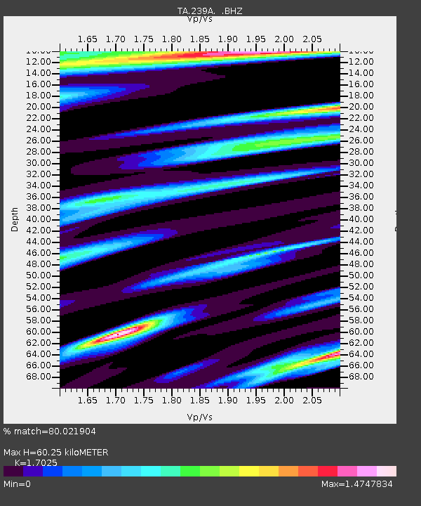
| Arrivals | |
| Ps | 7.1 SECOND |
| PpPs | 25 SECOND |
| PsPs/PpSs | 32 SECOND |

