
W36A Wetumka, OK, USA - Earthquake Result Viewer
| ||||||||||||||||||
| ||||||||||||||||||
| ||||||||||||||||||
|
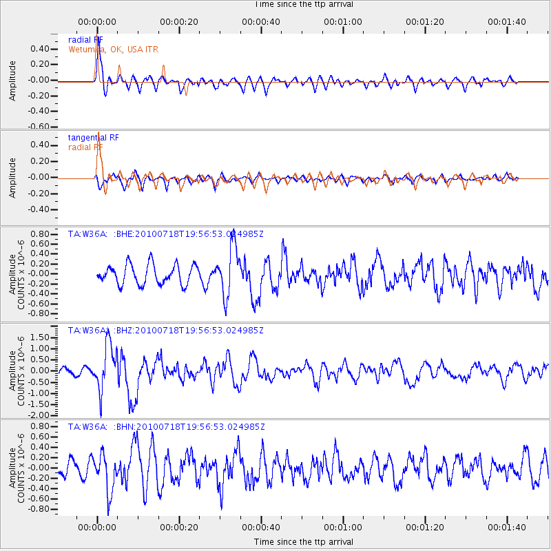
Signal To Noise
| Channel | StoN | STA | LTA |
| TA:W36A: :BHZ:20100718T19:56:53.024985Z | 5.569523 | 1.0482735E-6 | 1.8821603E-7 |
| TA:W36A: :BHN:20100718T19:56:53.024985Z | 3.2288702 | 3.6971824E-7 | 1.14503905E-7 |
| TA:W36A: :BHE:20100718T19:56:53.024985Z | 2.5758474 | 5.0466133E-7 | 1.959205E-7 |
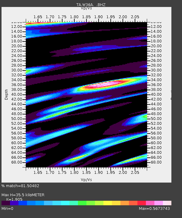
| Arrivals | |
| Ps | 5.3 SECOND |
| PpPs | 15 SECOND |
| PsPs/PpSs | 21 SECOND |

