X35A Drake, OK, USA - Earthquake Result Viewer
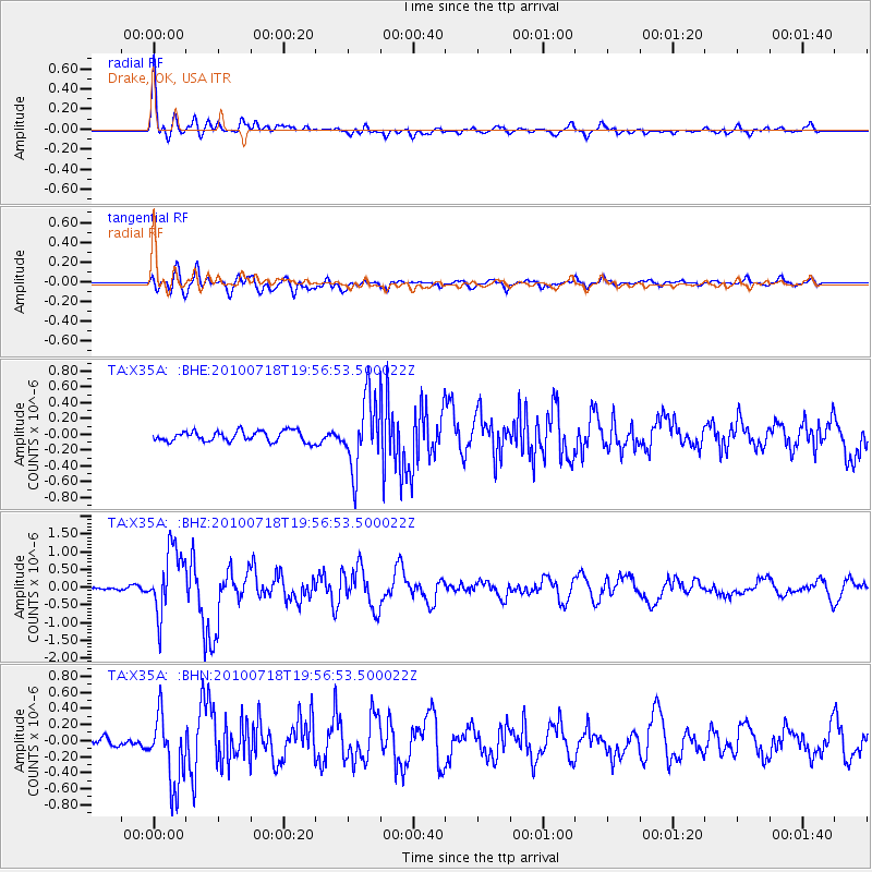
Earthquake location: Fox Islands, Aleutian Islands
Earthquake latitude/longitude: 52.8/-169.7
Earthquake time(UTC): 2010/07/18 (199) 19:48:04 GMT
Earthquake Depth: 10 km
Earthquake Magnitude: 5.6 MB, 5.6 MS, 6.0 MW, 6.0 MW
Earthquake Catalog/Contributor: WHDF/NEIC
Network: TA USArray Transportable Network (new EarthScope stations)
Station: X35A Drake, OK, USA
Lat/Lon: 34.40 N/96.97 W
Elevation: 300 m
Distance: 53.4 deg
Az: 79.495 deg
Baz: 313.802 deg
Ray Param: 0.06610524
Estimated Moho Depth: 19.25 km
Estimated Crust Vp/Vs: 2.08
Assumed Crust Vp: 6.426 km/s
Estimated Crust Vs: 3.086 km/s
Estimated Crust Poisson's Ratio: 0.35
Radial Match: 87.10731 %
Radial Bump: 400
Transverse Match: 80.88579 %
Transverse Bump: 400
SOD ConfigId: 319893
Insert Time: 2011-01-05 07:40:39.337 +0000
GWidth: 2.5
Max Bumps: 400
Tol: 0.001

Signal To Noise

ChannelStoNSTALTA
TA:X35A: :BHZ:20100718T19:56:53.500022Z11.5118939.2436125E-78.02962E-8
TA:X35A: :BHN:20100718T19:56:53.500022Z8.893644.3717438E-74.9155847E-8
TA:X35A: :BHE:20100718T19:56:53.500022Z6.5863874.4190796E-76.7094135E-8
Arrivals
Ps3.4 SECOND
PpPs8.8 SECOND
PsPs/PpSs12 SECOND