X36A Centrahoma, OK, USA - Earthquake Result Viewer
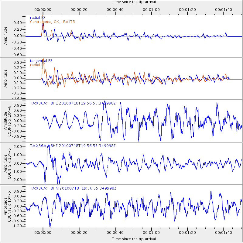
Earthquake location: Fox Islands, Aleutian Islands
Earthquake latitude/longitude: 52.8/-169.7
Earthquake time(UTC): 2010/07/18 (199) 19:48:04 GMT
Earthquake Depth: 10 km
Earthquake Magnitude: 5.6 MB, 5.6 MS, 6.0 MW, 6.0 MW
Earthquake Catalog/Contributor: WHDF/NEIC
Network: TA USArray Transportable Network (new EarthScope stations)
Station: X36A Centrahoma, OK, USA
Lat/Lon: 34.57 N/96.35 W
Elevation: 211 m
Distance: 53.7 deg
Az: 78.901 deg
Baz: 313.799 deg
Ray Param: 0.06593605
Estimated Moho Depth: 17.0 km
Estimated Crust Vp/Vs: 1.65
Assumed Crust Vp: 6.426 km/s
Estimated Crust Vs: 3.901 km/s
Estimated Crust Poisson's Ratio: 0.21
Radial Match: 85.540825 %
Radial Bump: 400
Transverse Match: 59.156013 %
Transverse Bump: 400
SOD ConfigId: 319893
Insert Time: 2011-01-05 07:40:48.841 +0000
GWidth: 2.5
Max Bumps: 400
Tol: 0.001

Signal To Noise

ChannelStoNSTALTA
TA:X36A: :BHZ:20100718T19:56:55.349998Z8.3349831.3077656E-61.5690082E-7
TA:X36A: :BHN:20100718T19:56:55.349998Z3.42638376.2029653E-71.8103535E-7
TA:X36A: :BHE:20100718T19:56:55.349998Z2.5559347.0177964E-72.7456878E-7
Arrivals
Ps1.8 SECOND
PpPs6.6 SECOND
PsPs/PpSs8.4 SECOND