
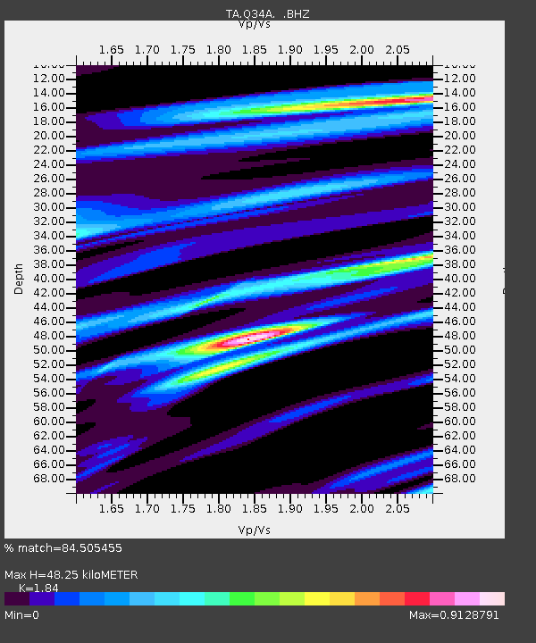
Q34A Chapman, KS, USA - Earthquake Result Viewer
| ||||||||||||||||||
| ||||||||||||||||||
| ||||||||||||||||||
|
Signal To Noise
| Channel | StoN | STA | LTA |
| TA:Q34A: :BHZ:20100718T19:56:30.950004Z | 5.055449 | 9.008151E-7 | 1.7818697E-7 |
| TA:Q34A: :BHN:20100718T19:56:30.950004Z | 2.8882658 | 4.3663422E-7 | 1.5117521E-7 |
| TA:Q34A: :BHE:20100718T19:56:30.950004Z | 4.0377393 | 4.122565E-7 | 1.0210083E-7 |
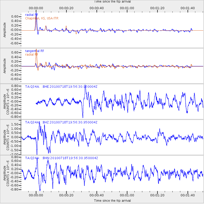
| Arrivals | |
| Ps | 6.6 SECOND |
| PpPs | 20 SECOND |
| PsPs/PpSs | 27 SECOND |

