You are here: Home > Network List > US - United States National Seismic Network Stations List
> Station GLMI Grayling, Michigan, USA > Earthquake Result Viewer
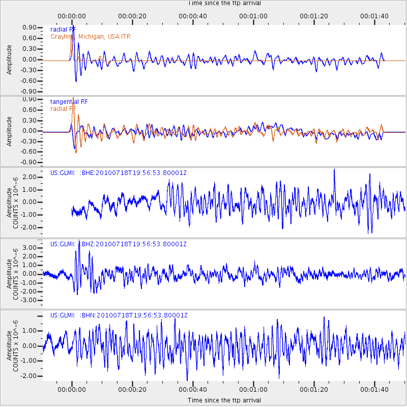
GLMI Grayling, Michigan, USA - Earthquake Result Viewer
*The percent match for this event was below the threshold and hence no stack was calculated.
| Earthquake location: |
Fox Islands, Aleutian Islands |
| Earthquake latitude/longitude: |
52.8/-169.7 |
| Earthquake time(UTC): |
2010/07/18 (199) 19:48:04 GMT |
| Earthquake Depth: |
10 km |
| Earthquake Magnitude: |
5.6 MB, 5.6 MS, 6.0 MW, 6.0 MW |
| Earthquake Catalog/Contributor: |
WHDF/NEIC |
|
| Network: |
US United States National Seismic Network |
| Station: |
GLMI Grayling, Michigan, USA |
| Lat/Lon: |
44.82 N/84.62 W |
| Elevation: |
387 m |
|
| Distance: |
53.5 deg |
| Az: |
61.929 deg |
| Baz: |
311.185 deg |
| Ray Param: |
$rayparam |
*The percent match for this event was below the threshold and hence was not used in the summary stack. |
|
| Radial Match: |
66.61778 % |
| Radial Bump: |
400 |
| Transverse Match: |
39.925667 % |
| Transverse Bump: |
400 |
| SOD ConfigId: |
319893 |
| Insert Time: |
2011-01-05 07:48:25.975 +0000 |
| GWidth: |
2.5 |
| Max Bumps: |
400 |
| Tol: |
0.001 |
|
Signal To Noise
| Channel | StoN | STA | LTA |
| US:GLMI: :BHZ:20100718T19:56:53.80001Z | 6.9078546 | 1.3722398E-6 | 1.986492E-7 |
| US:GLMI: :BHN:20100718T19:56:53.80001Z | 1.1656301 | 6.8580414E-7 | 5.8835485E-7 |
| US:GLMI: :BHE:20100718T19:56:53.80001Z | 1.7940571 | 8.638736E-7 | 4.815196E-7 |
| Arrivals |
| Ps | |
| PpPs | |
| PsPs/PpSs | |


