You are here: Home > Network List > GS - US Geological Survey Networks Stations List
> Station OK051 E0350 and S34600 roads, Ralston OK > Earthquake Result Viewer
OK051 E0350 and S34600 roads, Ralston OK - Earthquake Result Viewer
*The percent match for this event was below the threshold and hence no stack was calculated.
| Earthquake location: |
Southeast Of Honshu, Japan |
| Earthquake latitude/longitude: |
31.0/141.8 |
| Earthquake time(UTC): |
2023/09/21 (264) 21:22:12 GMT |
| Earthquake Depth: |
13 km |
| Earthquake Magnitude: |
5.7 Mww |
| Earthquake Catalog/Contributor: |
NEIC PDE/us |
|
| Network: |
GS US Geological Survey Networks |
| Station: |
OK051 E0350 and S34600 roads, Ralston OK |
| Lat/Lon: |
36.50 N/96.84 W |
| Elevation: |
263 m |
|
| Distance: |
93.3 deg |
| Az: |
43.577 deg |
| Baz: |
312.695 deg |
| Ray Param: |
$rayparam |
*The percent match for this event was below the threshold and hence was not used in the summary stack. |
|
| Radial Match: |
55.481354 % |
| Radial Bump: |
400 |
| Transverse Match: |
61.201744 % |
| Transverse Bump: |
400 |
| SOD ConfigId: |
31937991 |
| Insert Time: |
2023-10-05 21:54:06.259 +0000 |
| GWidth: |
2.5 |
| Max Bumps: |
400 |
| Tol: |
0.001 |
|
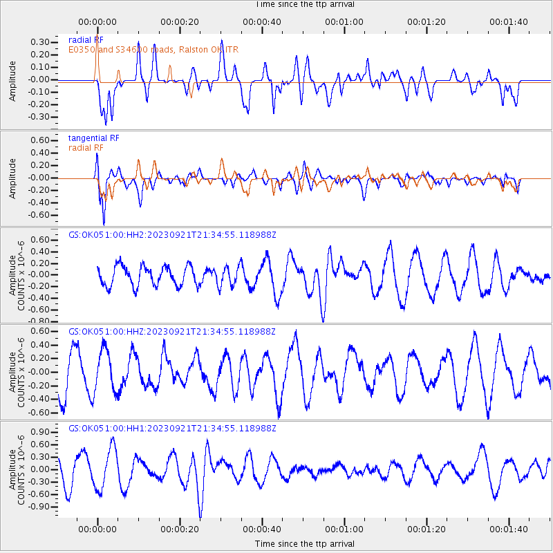
Signal To Noise
| Channel | StoN | STA | LTA |
| GS:OK051:00:HHZ:20230921T21:34:55.118988Z | 1.0952698 | 3.0420458E-7 | 2.7774396E-7 |
| GS:OK051:00:HH1:20230921T21:34:55.118988Z | 1.6190248 | 5.058223E-7 | 3.1242408E-7 |
| GS:OK051:00:HH2:20230921T21:34:55.118988Z | 1.010514 | 1.6835195E-7 | 1.6660032E-7 |
| Arrivals |
| Ps | |
| PpPs | |
| PsPs/PpSs | |


