You are here: Home > Network List > PF - Volcanologic Network of Piton de Fournaise-OVPF Stations List
> Station HIM cratere Himiltrude > Earthquake Result Viewer
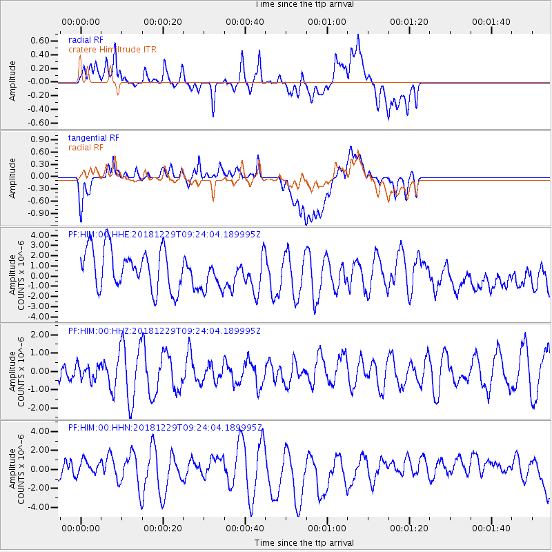
HIM cratere Himiltrude - Earthquake Result Viewer
*The percent match for this event was below the threshold and hence no stack was calculated.
| Earthquake location: |
Mindanao, Philippines |
| Earthquake latitude/longitude: |
5.8/126.9 |
| Earthquake time(UTC): |
2018/12/29 (363) 09:13:01 GMT |
| Earthquake Depth: |
62 km |
| Earthquake Magnitude: |
5.3 Mww |
| Earthquake Catalog/Contributor: |
NEIC PDE/us |
|
| Network: |
PF Volcanologic Network of Piton de Fournaise-OVPF |
| Station: |
HIM cratere Himiltrude |
| Lat/Lon: |
21.21 S/55.72 E |
| Elevation: |
1958 m |
|
| Distance: |
74.8 deg |
| Az: |
246.286 deg |
| Baz: |
77.501 deg |
| Ray Param: |
$rayparam |
*The percent match for this event was below the threshold and hence was not used in the summary stack. |
|
| Radial Match: |
51.569878 % |
| Radial Bump: |
400 |
| Transverse Match: |
53.252728 % |
| Transverse Bump: |
400 |
| SOD ConfigId: |
3257111 |
| Insert Time: |
2019-01-25 08:34:15.728 +0000 |
| GWidth: |
2.5 |
| Max Bumps: |
400 |
| Tol: |
0.001 |
|
Signal To Noise
| Channel | StoN | STA | LTA |
| PF:HIM:00:HHZ:20181229T09:24:04.189995Z | 0.33865857 | 4.0537373E-7 | 1.1969983E-6 |
| PF:HIM:00:HHN:20181229T09:24:04.189995Z | 0.6156084 | 1.0031639E-6 | 1.6295487E-6 |
| PF:HIM:00:HHE:20181229T09:24:04.189995Z | 0.8617175 | 1.7012751E-6 | 1.9742838E-6 |
| Arrivals |
| Ps | |
| PpPs | |
| PsPs/PpSs | |


