You are here: Home > Network List > US - United States National Seismic Network Stations List
> Station HAWA Hanford, Washington, USA > Earthquake Result Viewer
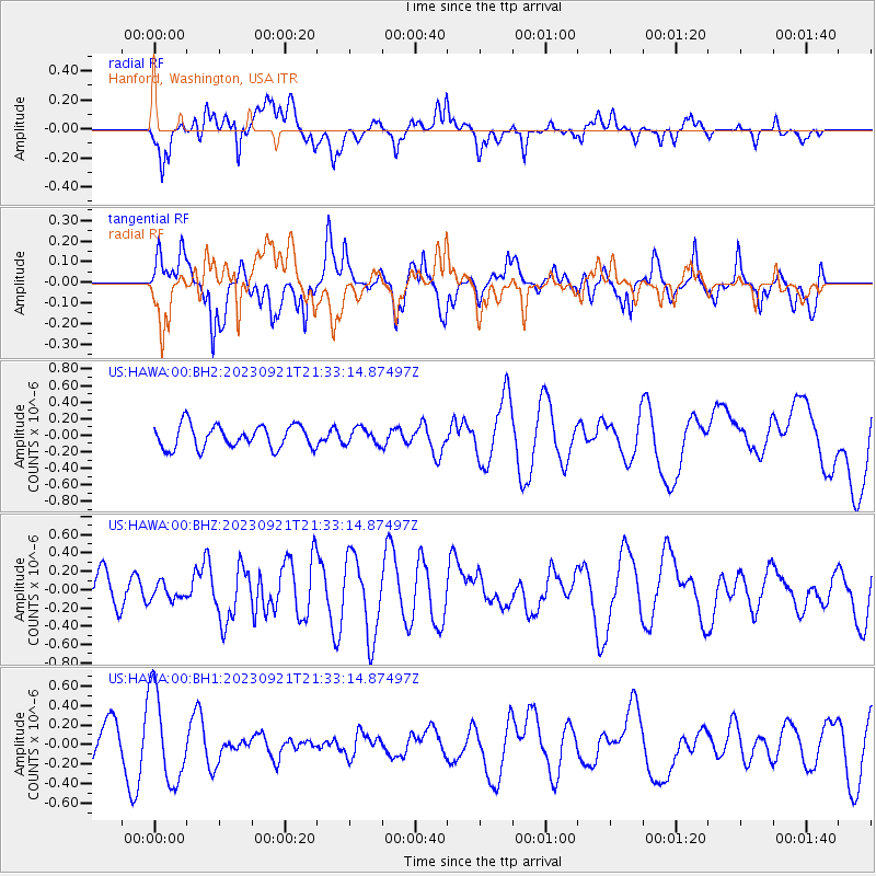
HAWA Hanford, Washington, USA - Earthquake Result Viewer
*The percent match for this event was below the threshold and hence no stack was calculated.
| Earthquake location: |
Southeast Of Honshu, Japan |
| Earthquake latitude/longitude: |
31.0/141.8 |
| Earthquake time(UTC): |
2023/09/21 (264) 21:22:12 GMT |
| Earthquake Depth: |
13 km |
| Earthquake Magnitude: |
5.7 Mww |
| Earthquake Catalog/Contributor: |
NEIC PDE/us |
|
| Network: |
US United States National Seismic Network |
| Station: |
HAWA Hanford, Washington, USA |
| Lat/Lon: |
46.39 N/119.53 W |
| Elevation: |
364 m |
|
| Distance: |
73.7 deg |
| Az: |
45.467 deg |
| Baz: |
297.777 deg |
| Ray Param: |
$rayparam |
*The percent match for this event was below the threshold and hence was not used in the summary stack. |
|
| Radial Match: |
53.470787 % |
| Radial Bump: |
400 |
| Transverse Match: |
70.39655 % |
| Transverse Bump: |
400 |
| SOD ConfigId: |
31937991 |
| Insert Time: |
2023-10-05 22:04:52.141 +0000 |
| GWidth: |
2.5 |
| Max Bumps: |
400 |
| Tol: |
0.001 |
|
Signal To Noise
| Channel | StoN | STA | LTA |
| US:HAWA:00:BHZ:20230921T21:33:14.87497Z | 0.45202854 | 8.9850154E-8 | 1.9877098E-7 |
| US:HAWA:00:BH1:20230921T21:33:14.87497Z | 2.3902576 | 4.616786E-7 | 1.9315014E-7 |
| US:HAWA:00:BH2:20230921T21:33:14.87497Z | 0.69629854 | 9.6738034E-8 | 1.3893184E-7 |
| Arrivals |
| Ps | |
| PpPs | |
| PsPs/PpSs | |


