You are here: Home > Network List > WY - Yellowstone Wyoming Seismic Network Stations List
> Station YUF Upper Falls, WY, USA > Earthquake Result Viewer
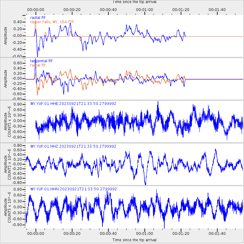
YUF Upper Falls, WY, USA - Earthquake Result Viewer
*The percent match for this event was below the threshold and hence no stack was calculated.
| Earthquake location: |
Southeast Of Honshu, Japan |
| Earthquake latitude/longitude: |
31.0/141.8 |
| Earthquake time(UTC): |
2023/09/21 (264) 21:22:12 GMT |
| Earthquake Depth: |
13 km |
| Earthquake Magnitude: |
5.7 Mww |
| Earthquake Catalog/Contributor: |
NEIC PDE/us |
|
| Network: |
WY Yellowstone Wyoming Seismic Network |
| Station: |
YUF Upper Falls, WY, USA |
| Lat/Lon: |
44.71 N/110.51 W |
| Elevation: |
2394 m |
|
| Distance: |
80.0 deg |
| Az: |
43.617 deg |
| Baz: |
303.783 deg |
| Ray Param: |
$rayparam |
*The percent match for this event was below the threshold and hence was not used in the summary stack. |
|
| Radial Match: |
53.113625 % |
| Radial Bump: |
400 |
| Transverse Match: |
63.718956 % |
| Transverse Bump: |
400 |
| SOD ConfigId: |
31937991 |
| Insert Time: |
2023-10-05 22:07:21.709 +0000 |
| GWidth: |
2.5 |
| Max Bumps: |
400 |
| Tol: |
0.001 |
|
Signal To Noise
| Channel | StoN | STA | LTA |
| WY:YUF:01:HHZ:20230921T21:33:50.279999Z | 0.66245425 | 1.253735E-7 | 1.8925608E-7 |
| WY:YUF:01:HHN:20230921T21:33:50.279999Z | 1.1183333 | 3.440639E-7 | 3.0765773E-7 |
| WY:YUF:01:HHE:20230921T21:33:50.279999Z | 0.7960639 | 2.3043751E-7 | 2.8947113E-7 |
| Arrivals |
| Ps | |
| PpPs | |
| PsPs/PpSs | |


