You are here: Home > Network List > TA - USArray Transportable Network (new EarthScope stations) Stations List
> Station H20A Greybull, WY, USA > Earthquake Result Viewer
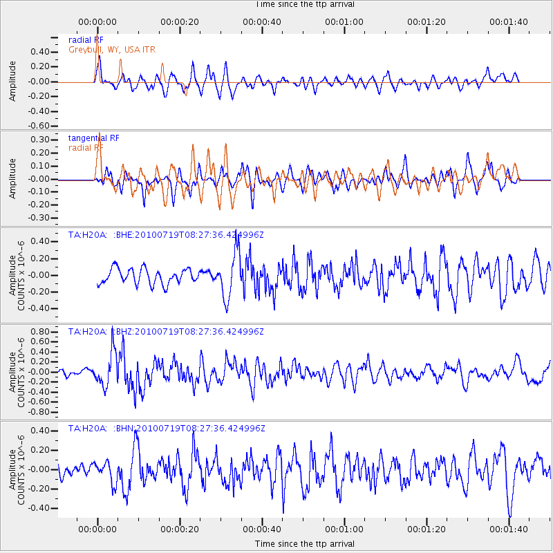
H20A Greybull, WY, USA - Earthquake Result Viewer
*The percent match for this event was below the threshold and hence no stack was calculated.
| Earthquake location: |
Fox Islands, Aleutian Islands |
| Earthquake latitude/longitude: |
52.7/-169.3 |
| Earthquake time(UTC): |
2010/07/19 (200) 08:20:30 GMT |
| Earthquake Depth: |
10 km |
| Earthquake Magnitude: |
5.6 MW, 5.2 MS, 5.4 MB, 5.1 ML |
| Earthquake Catalog/Contributor: |
WHDF/NEIC |
|
| Network: |
TA USArray Transportable Network (new EarthScope stations) |
| Station: |
H20A Greybull, WY, USA |
| Lat/Lon: |
44.49 N/108.00 W |
| Elevation: |
1236 m |
|
| Distance: |
40.3 deg |
| Az: |
76.297 deg |
| Baz: |
304.221 deg |
| Ray Param: |
$rayparam |
*The percent match for this event was below the threshold and hence was not used in the summary stack. |
|
| Radial Match: |
54.89123 % |
| Radial Bump: |
400 |
| Transverse Match: |
65.99917 % |
| Transverse Bump: |
400 |
| SOD ConfigId: |
319893 |
| Insert Time: |
2011-01-05 08:06:08.546 +0000 |
| GWidth: |
2.5 |
| Max Bumps: |
400 |
| Tol: |
0.001 |
|
Signal To Noise
| Channel | StoN | STA | LTA |
| TA:H20A: :BHZ:20100719T08:27:36.424996Z | 4.459001 | 3.4638478E-7 | 7.768215E-8 |
| TA:H20A: :BHN:20100719T08:27:36.424996Z | 0.9308107 | 1.078818E-7 | 1.1590091E-7 |
| TA:H20A: :BHE:20100719T08:27:36.424996Z | 3.1086435 | 2.7698434E-7 | 8.9101356E-8 |
| Arrivals |
| Ps | |
| PpPs | |
| PsPs/PpSs | |


