You are here: Home > Network List > TA - USArray Transportable Network (new EarthScope stations) Stations List
> Station 130A Snyder, TX, USA > Earthquake Result Viewer
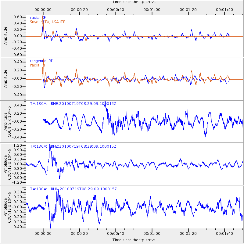
130A Snyder, TX, USA - Earthquake Result Viewer
*The percent match for this event was below the threshold and hence no stack was calculated.
| Earthquake location: |
Fox Islands, Aleutian Islands |
| Earthquake latitude/longitude: |
52.7/-169.3 |
| Earthquake time(UTC): |
2010/07/19 (200) 08:20:30 GMT |
| Earthquake Depth: |
10 km |
| Earthquake Magnitude: |
5.6 MW, 5.2 MS, 5.4 MB, 5.1 ML |
| Earthquake Catalog/Contributor: |
WHDF/NEIC |
|
| Network: |
TA USArray Transportable Network (new EarthScope stations) |
| Station: |
130A Snyder, TX, USA |
| Lat/Lon: |
32.60 N/100.97 W |
| Elevation: |
676 m |
|
| Distance: |
52.1 deg |
| Az: |
84.19 deg |
| Baz: |
314.113 deg |
| Ray Param: |
$rayparam |
*The percent match for this event was below the threshold and hence was not used in the summary stack. |
|
| Radial Match: |
78.73658 % |
| Radial Bump: |
400 |
| Transverse Match: |
68.409676 % |
| Transverse Bump: |
358 |
| SOD ConfigId: |
319893 |
| Insert Time: |
2011-01-05 08:15:37.292 +0000 |
| GWidth: |
2.5 |
| Max Bumps: |
400 |
| Tol: |
0.001 |
|
Signal To Noise
| Channel | StoN | STA | LTA |
| TA:130A: :BHZ:20100719T08:29:09.100015Z | 5.466647 | 5.868E-7 | 1.0734185E-7 |
| TA:130A: :BHN:20100719T08:29:09.100015Z | 2.3110843 | 1.6847113E-7 | 7.289701E-8 |
| TA:130A: :BHE:20100719T08:29:09.100015Z | 2.095536 | 2.2856382E-7 | 1.0907177E-7 |
| Arrivals |
| Ps | |
| PpPs | |
| PsPs/PpSs | |


