You are here: Home > Network List > US - United States National Seismic Network Stations List
> Station HAWA Hanford, Washington, USA > Earthquake Result Viewer
HAWA Hanford, Washington, USA - Earthquake Result Viewer
*The percent match for this event was below the threshold and hence no stack was calculated.
| Earthquake location: |
Bismarck Sea |
| Earthquake latitude/longitude: |
-3.2/146.4 |
| Earthquake time(UTC): |
2019/01/17 (017) 16:53:15 GMT |
| Earthquake Depth: |
10 km |
| Earthquake Magnitude: |
5.7 Mww |
| Earthquake Catalog/Contributor: |
NEIC PDE/us |
|
| Network: |
US United States National Seismic Network |
| Station: |
HAWA Hanford, Washington, USA |
| Lat/Lon: |
46.39 N/119.53 W |
| Elevation: |
364 m |
|
| Distance: |
95.1 deg |
| Az: |
43.882 deg |
| Baz: |
270.691 deg |
| Ray Param: |
$rayparam |
*The percent match for this event was below the threshold and hence was not used in the summary stack. |
|
| Radial Match: |
58.310516 % |
| Radial Bump: |
400 |
| Transverse Match: |
61.018547 % |
| Transverse Bump: |
400 |
| SOD ConfigId: |
3260311 |
| Insert Time: |
2019-01-31 17:04:23.827 +0000 |
| GWidth: |
2.5 |
| Max Bumps: |
400 |
| Tol: |
0.001 |
|
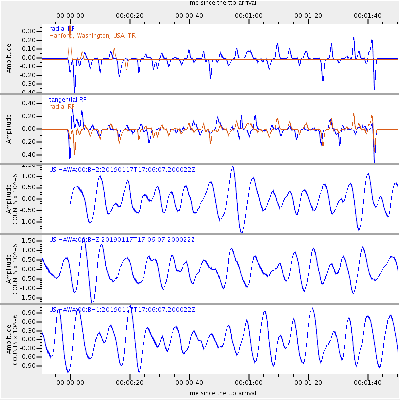
Signal To Noise
| Channel | StoN | STA | LTA |
| US:HAWA:00:BHZ:20190117T17:06:07.200022Z | 1.3734611 | 9.525437E-7 | 6.9353524E-7 |
| US:HAWA:00:BH1:20190117T17:06:07.200022Z | 3.3854256 | 7.7357305E-7 | 2.28501E-7 |
| US:HAWA:00:BH2:20190117T17:06:07.200022Z | 0.72717476 | 3.8220082E-7 | 5.2559693E-7 |
| Arrivals |
| Ps | |
| PpPs | |
| PsPs/PpSs | |


