You are here: Home > Network List > UW - Pacific Northwest Regional Seismic Network Stations List
> Station IRON Crane, OR, USA > Earthquake Result Viewer
IRON Crane, OR, USA - Earthquake Result Viewer
*The percent match for this event was below the threshold and hence no stack was calculated.
| Earthquake location: |
Vanuatu Islands |
| Earthquake latitude/longitude: |
-15.6/167.7 |
| Earthquake time(UTC): |
2023/09/28 (271) 14:40:26 GMT |
| Earthquake Depth: |
126 km |
| Earthquake Magnitude: |
6.0 mww |
| Earthquake Catalog/Contributor: |
NEIC PDE/us |
|
| Network: |
UW Pacific Northwest Regional Seismic Network |
| Station: |
IRON Crane, OR, USA |
| Lat/Lon: |
43.36 N/118.47 W |
| Elevation: |
1226 m |
|
| Distance: |
89.2 deg |
| Az: |
44.469 deg |
| Baz: |
247.763 deg |
| Ray Param: |
$rayparam |
*The percent match for this event was below the threshold and hence was not used in the summary stack. |
|
| Radial Match: |
65.91911 % |
| Radial Bump: |
288 |
| Transverse Match: |
69.66711 % |
| Transverse Bump: |
400 |
| SOD ConfigId: |
31937991 |
| Insert Time: |
2023-10-12 15:05:47.014 +0000 |
| GWidth: |
2.5 |
| Max Bumps: |
400 |
| Tol: |
0.001 |
|
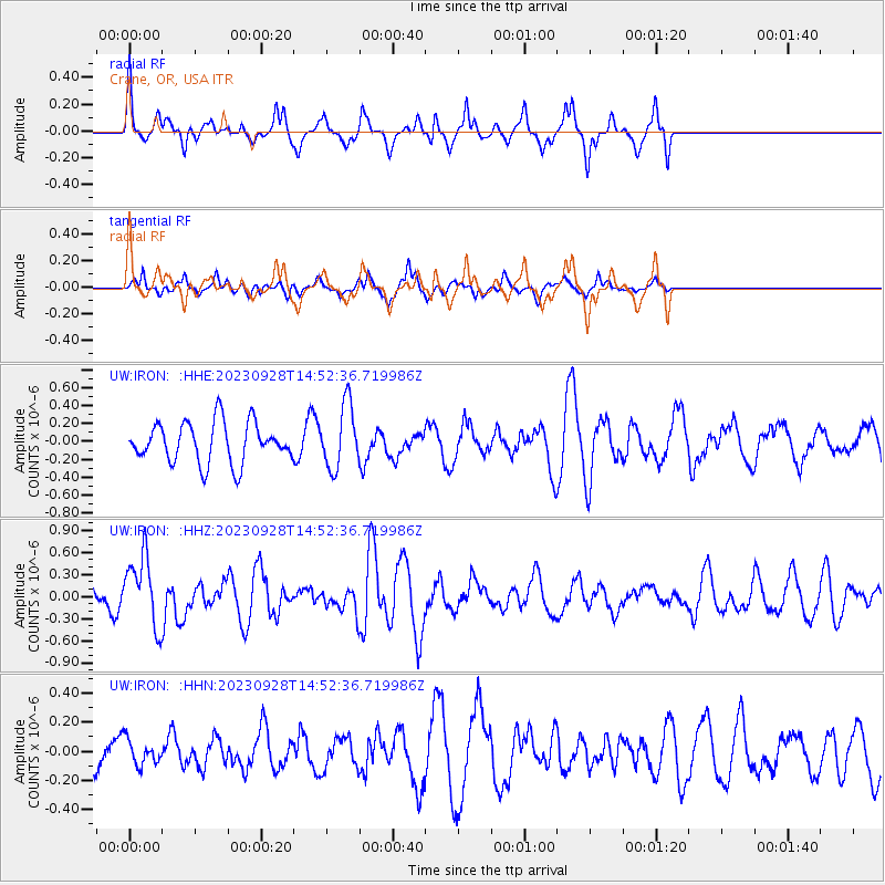
Signal To Noise
| Channel | StoN | STA | LTA |
| UW:IRON: :HHZ:20230928T14:52:36.719986Z | 3.2203796 | 4.6380916E-7 | 1.4402313E-7 |
| UW:IRON: :HHN:20230928T14:52:36.719986Z | 0.76252794 | 8.620652E-8 | 1.1305359E-7 |
| UW:IRON: :HHE:20230928T14:52:36.719986Z | 1.5708071 | 3.5142205E-7 | 2.2372069E-7 |
| Arrivals |
| Ps | |
| PpPs | |
| PsPs/PpSs | |


