You are here: Home > Network List > UW - Pacific Northwest Regional Seismic Network Stations List
> Station UMAT Pilot Rock, OR, USA > Earthquake Result Viewer
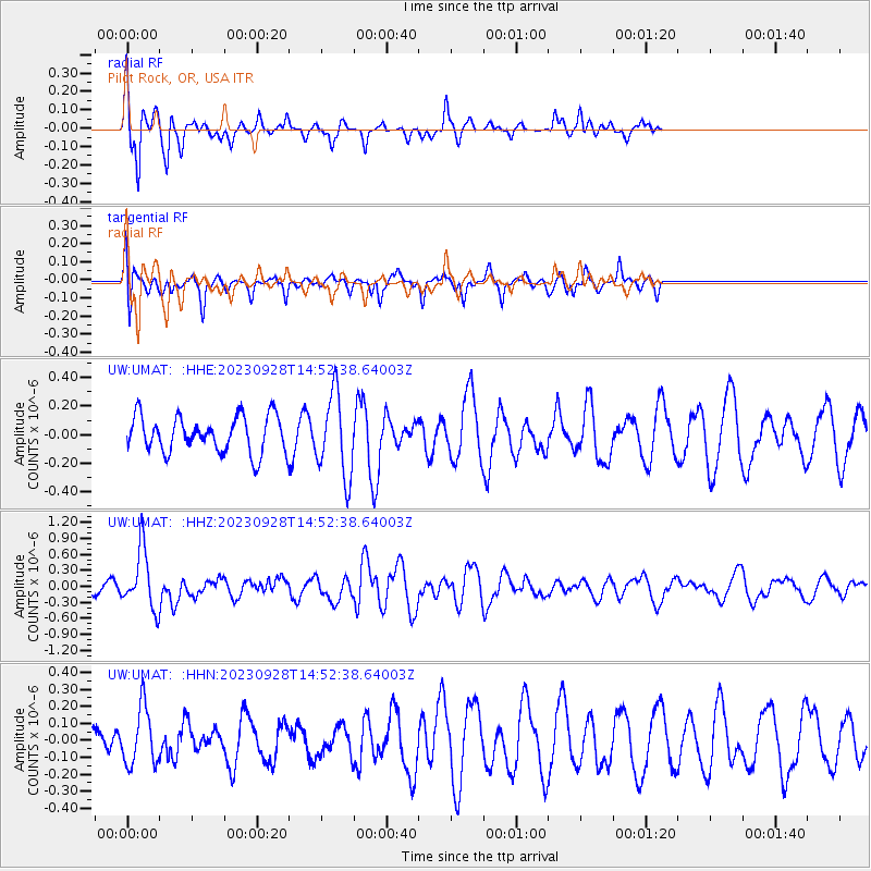
UMAT Pilot Rock, OR, USA - Earthquake Result Viewer
*The percent match for this event was below the threshold and hence no stack was calculated.
| Earthquake location: |
Vanuatu Islands |
| Earthquake latitude/longitude: |
-15.6/167.7 |
| Earthquake time(UTC): |
2023/09/28 (271) 14:40:26 GMT |
| Earthquake Depth: |
126 km |
| Earthquake Magnitude: |
6.0 mww |
| Earthquake Catalog/Contributor: |
NEIC PDE/us |
|
| Network: |
UW Pacific Northwest Regional Seismic Network |
| Station: |
UMAT Pilot Rock, OR, USA |
| Lat/Lon: |
45.29 N/118.96 W |
| Elevation: |
1318 m |
|
| Distance: |
89.6 deg |
| Az: |
42.55 deg |
| Baz: |
247.406 deg |
| Ray Param: |
$rayparam |
*The percent match for this event was below the threshold and hence was not used in the summary stack. |
|
| Radial Match: |
58.88839 % |
| Radial Bump: |
308 |
| Transverse Match: |
50.80435 % |
| Transverse Bump: |
387 |
| SOD ConfigId: |
31937991 |
| Insert Time: |
2023-10-12 15:07:07.041 +0000 |
| GWidth: |
2.5 |
| Max Bumps: |
400 |
| Tol: |
0.001 |
|
Signal To Noise
| Channel | StoN | STA | LTA |
| UW:UMAT: :HHZ:20230928T14:52:38.64003Z | 4.7136273 | 5.509633E-7 | 1.1688732E-7 |
| UW:UMAT: :HHN:20230928T14:52:38.64003Z | 1.864582 | 1.693577E-7 | 9.082878E-8 |
| UW:UMAT: :HHE:20230928T14:52:38.64003Z | 2.277638 | 2.86977E-7 | 1.2599766E-7 |
| Arrivals |
| Ps | |
| PpPs | |
| PsPs/PpSs | |


