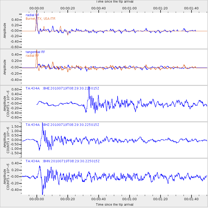
434A Burnet, TX, USA - Earthquake Result Viewer
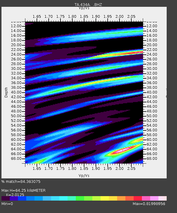
Earthquake location: Fox Islands, Aleutian Islands
Earthquake latitude/longitude: 52.7/-169.3
Earthquake time(UTC): 2010/07/19 (200) 08:20:30 GMT
Earthquake Depth: 10 km
Earthquake Magnitude: 5.6 MW, 5.2 MS, 5.4 MB, 5.1 ML
Earthquake Catalog/Contributor: WHDF/NEIC
Network: TA USArray Transportable Network (new EarthScope stations)
Station: 434A Burnet, TX, USA
Lat/Lon: 30.81 N/98.27 W
Elevation: 462 m
Distance: 54.9 deg
Az: 83.751 deg
Baz: 315.262 deg
Ray Param: 0.065117925
Estimated Moho Depth: 64.25 km
Estimated Crust Vp/Vs: 2.01
Assumed Crust Vp: 6.498 km/s
Estimated Crust Vs: 3.229 km/s
Estimated Crust Poisson's Ratio: 0.34
Radial Match: 84.363075 %
Radial Bump: 400
Transverse Match: 82.23307 %
Transverse Bump: 400
SOD ConfigId: 319893
Insert Time: 2011-01-05 08:27:36.332 +0000
GWidth: 2.5
Max Bumps: 400
Tol: 0.001

Signal To Noise

ChannelStoNSTALTA
TA:434A: :BHZ:20100719T08:29:30.225015Z9.0385437.5132624E-78.312471E-8
TA:434A: :BHN:20100719T08:29:30.225015Z8.5974022.2913497E-72.6651653E-8
TA:434A: :BHE:20100719T08:29:30.225015Z5.40689332.767544E-75.1185474E-8
Arrivals
Ps10 SECOND
PpPs28 SECOND
PsPs/PpSs39 SECOND