
334A Lometa, TX, USA - Earthquake Result Viewer
| ||||||||||||||||||
| ||||||||||||||||||
| ||||||||||||||||||
|
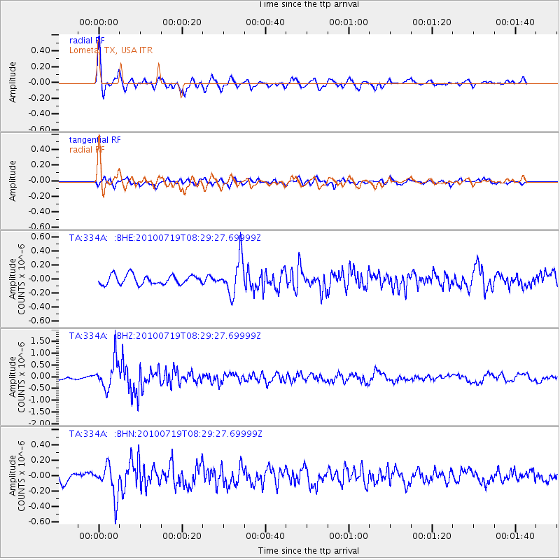
Signal To Noise
| Channel | StoN | STA | LTA |
| TA:334A: :BHZ:20100719T08:29:27.69999Z | 9.789391 | 6.3575703E-7 | 6.494347E-8 |
| TA:334A: :BHN:20100719T08:29:27.69999Z | 4.258144 | 2.1381257E-7 | 5.0212623E-8 |
| TA:334A: :BHE:20100719T08:29:27.69999Z | 3.9254882 | 2.5659332E-7 | 6.536596E-8 |
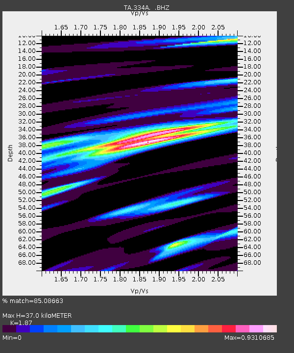
| Arrivals | |
| Ps | 5.2 SECOND |
| PpPs | 16 SECOND |
| PsPs/PpSs | 21 SECOND |

