335A Moody, TX, USA - Earthquake Result Viewer
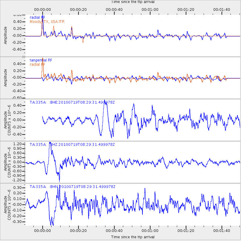
Earthquake location: Fox Islands, Aleutian Islands
Earthquake latitude/longitude: 52.7/-169.3
Earthquake time(UTC): 2010/07/19 (200) 08:20:30 GMT
Earthquake Depth: 10 km
Earthquake Magnitude: 5.6 MW, 5.2 MS, 5.4 MB, 5.1 ML
Earthquake Catalog/Contributor: WHDF/NEIC
Network: TA USArray Transportable Network (new EarthScope stations)
Station: 335A Moody, TX, USA
Lat/Lon: 31.28 N/97.43 W
Elevation: 217 m
Distance: 55.1 deg
Az: 82.725 deg
Baz: 315.106 deg
Ray Param: 0.06499856
Estimated Moho Depth: 39.25 km
Estimated Crust Vp/Vs: 1.80
Assumed Crust Vp: 6.347 km/s
Estimated Crust Vs: 3.526 km/s
Estimated Crust Poisson's Ratio: 0.28
Radial Match: 80.80933 %
Radial Bump: 400
Transverse Match: 77.72053 %
Transverse Bump: 400
SOD ConfigId: 319893
Insert Time: 2011-01-05 08:28:14.124 +0000
GWidth: 2.5
Max Bumps: 400
Tol: 0.001

Signal To Noise

ChannelStoNSTALTA
TA:335A: :BHZ:20100719T08:29:31.499978Z8.4464046.584139E-77.7951974E-8
TA:335A: :BHN:20100719T08:29:31.499978Z2.92160771.7666999E-76.047013E-8
TA:335A: :BHE:20100719T08:29:31.499978Z4.4350882.746512E-76.192688E-8
Arrivals
Ps5.2 SECOND
PpPs16 SECOND
PsPs/PpSs22 SECOND