You are here: Home > Network List > US - United States National Seismic Network Stations List
> Station EGMT Eagleton, Montana, USA > Earthquake Result Viewer
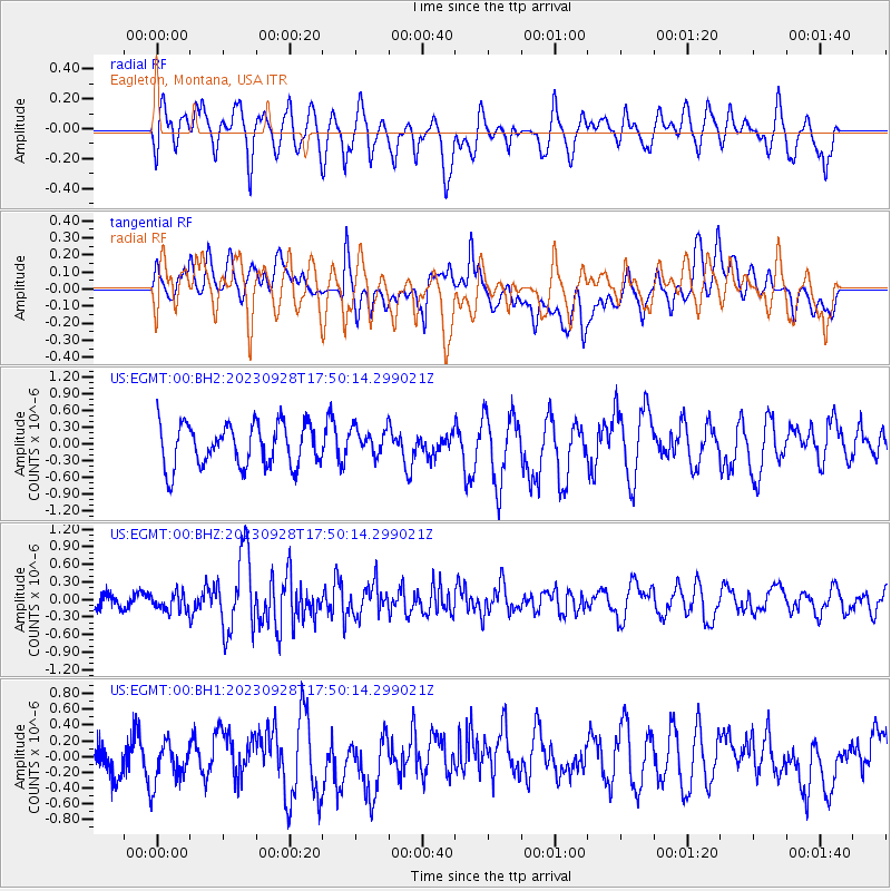
EGMT Eagleton, Montana, USA - Earthquake Result Viewer
*The percent match for this event was below the threshold and hence no stack was calculated.
| Earthquake location: |
Kuril Islands |
| Earthquake latitude/longitude: |
44.3/148.6 |
| Earthquake time(UTC): |
2023/09/28 (271) 17:40:04 GMT |
| Earthquake Depth: |
15 km |
| Earthquake Magnitude: |
5.8 mww |
| Earthquake Catalog/Contributor: |
NEIC PDE/us |
|
| Network: |
US United States National Seismic Network |
| Station: |
EGMT Eagleton, Montana, USA |
| Lat/Lon: |
48.02 N/109.75 W |
| Elevation: |
1055 m |
|
| Distance: |
65.3 deg |
| Az: |
46.383 deg |
| Baz: |
309.198 deg |
| Ray Param: |
$rayparam |
*The percent match for this event was below the threshold and hence was not used in the summary stack. |
|
| Radial Match: |
56.693275 % |
| Radial Bump: |
400 |
| Transverse Match: |
43.677994 % |
| Transverse Bump: |
400 |
| SOD ConfigId: |
31937991 |
| Insert Time: |
2023-10-12 18:07:37.488 +0000 |
| GWidth: |
2.5 |
| Max Bumps: |
400 |
| Tol: |
0.001 |
|
Signal To Noise
| Channel | StoN | STA | LTA |
| US:EGMT:00:BHZ:20230928T17:50:14.299021Z | 0.6980907 | 1.5176737E-7 | 2.1740351E-7 |
| US:EGMT:00:BH1:20230928T17:50:14.299021Z | 0.86530745 | 3.0410555E-7 | 3.514422E-7 |
| US:EGMT:00:BH2:20230928T17:50:14.299021Z | 0.6503423 | 2.4770193E-7 | 3.8087933E-7 |
| Arrivals |
| Ps | |
| PpPs | |
| PsPs/PpSs | |


