
635A Leesville, TX, USA - Earthquake Result Viewer

| ||||||||||||||||||
| ||||||||||||||||||
| ||||||||||||||||||
|
Signal To Noise
| Channel | StoN | STA | LTA |
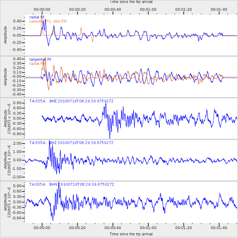
| TA:635A: :BHZ:20100719T08:29:39.675027Z | 7.9026694 | 7.1003575E-7 | 8.984759E-8 |
| TA:635A: :BHN:20100719T08:29:39.675027Z | 1.0230651 | 1.4622591E-7 | 1.4292925E-7 |
| TA:635A: :BHE:20100719T08:29:39.675027Z | 2.0239928 | 1.9414637E-7 | 9.592246E-8 |
| Arrivals | |
| Ps | 1.9 SECOND |
| PpPs | 6.8 SECOND |
| PsPs/PpSs | 8.7 SECOND |

