You are here: Home > Network List > TA - USArray Transportable Network (new EarthScope stations) Stations List
> Station 339A Huntington, TX, USA > Earthquake Result Viewer
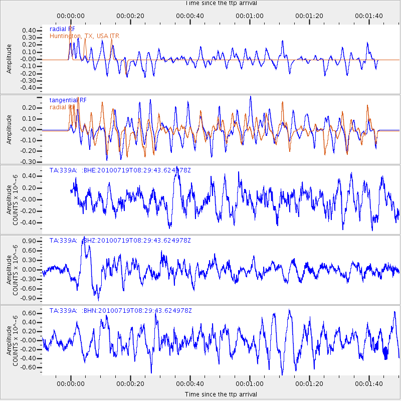
339A Huntington, TX, USA - Earthquake Result Viewer
*The percent match for this event was below the threshold and hence no stack was calculated.
| Earthquake location: |
Fox Islands, Aleutian Islands |
| Earthquake latitude/longitude: |
52.7/-169.3 |
| Earthquake time(UTC): |
2010/07/19 (200) 08:20:30 GMT |
| Earthquake Depth: |
10 km |
| Earthquake Magnitude: |
5.6 MW, 5.2 MS, 5.4 MB, 5.1 ML |
| Earthquake Catalog/Contributor: |
WHDF/NEIC |
|
| Network: |
TA USArray Transportable Network (new EarthScope stations) |
| Station: |
339A Huntington, TX, USA |
| Lat/Lon: |
31.33 N/94.56 W |
| Elevation: |
82 m |
|
| Distance: |
56.8 deg |
| Az: |
80.576 deg |
| Baz: |
315.388 deg |
| Ray Param: |
$rayparam |
*The percent match for this event was below the threshold and hence was not used in the summary stack. |
|
| Radial Match: |
58.40646 % |
| Radial Bump: |
400 |
| Transverse Match: |
64.09089 % |
| Transverse Bump: |
400 |
| SOD ConfigId: |
319893 |
| Insert Time: |
2011-01-05 08:30:40.784 +0000 |
| GWidth: |
2.5 |
| Max Bumps: |
400 |
| Tol: |
0.001 |
|
Signal To Noise
| Channel | StoN | STA | LTA |
| TA:339A: :BHZ:20100719T08:29:43.624978Z | 4.7897196 | 4.9231795E-7 | 1.0278638E-7 |
| TA:339A: :BHN:20100719T08:29:43.624978Z | 1.9990368 | 2.2486871E-7 | 1.1248853E-7 |
| TA:339A: :BHE:20100719T08:29:43.624978Z | 1.8846713 | 2.451221E-7 | 1.3006093E-7 |
| Arrivals |
| Ps | |
| PpPs | |
| PsPs/PpSs | |


