You are here: Home > Network List > US - United States National Seismic Network Stations List
> Station EGMT Eagleton, Montana, USA > Earthquake Result Viewer
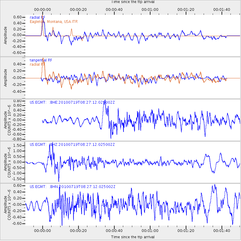
EGMT Eagleton, Montana, USA - Earthquake Result Viewer
*The percent match for this event was below the threshold and hence no stack was calculated.
| Earthquake location: |
Fox Islands, Aleutian Islands |
| Earthquake latitude/longitude: |
52.7/-169.3 |
| Earthquake time(UTC): |
2010/07/19 (200) 08:20:30 GMT |
| Earthquake Depth: |
10 km |
| Earthquake Magnitude: |
5.6 MW, 5.2 MS, 5.4 MB, 5.1 ML |
| Earthquake Catalog/Contributor: |
WHDF/NEIC |
|
| Network: |
US United States National Seismic Network |
| Station: |
EGMT Eagleton, Montana, USA |
| Lat/Lon: |
48.02 N/109.75 W |
| Elevation: |
1055 m |
|
| Distance: |
37.4 deg |
| Az: |
72.551 deg |
| Baz: |
300.036 deg |
| Ray Param: |
$rayparam |
*The percent match for this event was below the threshold and hence was not used in the summary stack. |
|
| Radial Match: |
77.76522 % |
| Radial Bump: |
400 |
| Transverse Match: |
49.75769 % |
| Transverse Bump: |
400 |
| SOD ConfigId: |
319893 |
| Insert Time: |
2011-01-05 08:40:32.862 +0000 |
| GWidth: |
2.5 |
| Max Bumps: |
400 |
| Tol: |
0.001 |
|
Signal To Noise
| Channel | StoN | STA | LTA |
| US:EGMT: :BHZ:20100719T08:27:12.025002Z | 9.514336 | 5.793691E-7 | 6.089433E-8 |
| US:EGMT: :BHN:20100719T08:27:12.025002Z | 2.3953164 | 2.384002E-7 | 9.9527654E-8 |
| US:EGMT: :BHE:20100719T08:27:12.025002Z | 3.4618633 | 3.4894705E-7 | 1.0079747E-7 |
| Arrivals |
| Ps | |
| PpPs | |
| PsPs/PpSs | |


