You are here: Home > Network List > US - United States National Seismic Network Stations List
> Station CBKS Cedar Bluff, Kansas, USA > Earthquake Result Viewer
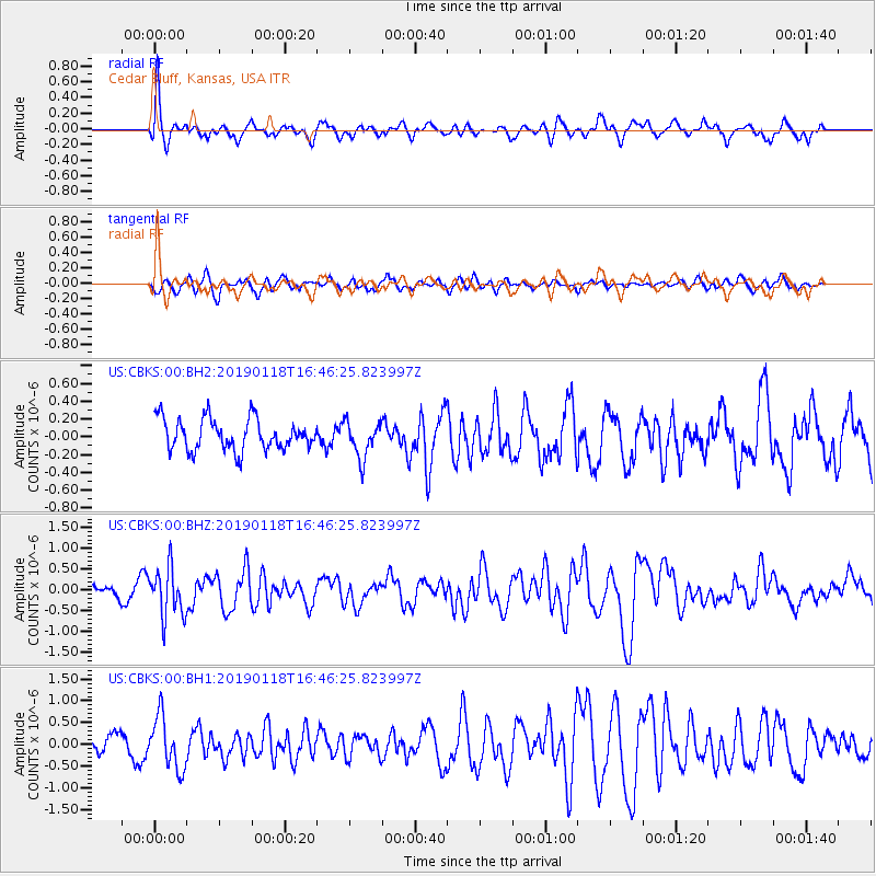
CBKS Cedar Bluff, Kansas, USA - Earthquake Result Viewer
*The percent match for this event was below the threshold and hence no stack was calculated.
| Earthquake location: |
Northern East Pacific Rise |
| Earthquake latitude/longitude: |
8.3/-103.5 |
| Earthquake time(UTC): |
2019/01/18 (018) 16:40:42 GMT |
| Earthquake Depth: |
10 km |
| Earthquake Magnitude: |
6.0 Mww |
| Earthquake Catalog/Contributor: |
NEIC PDE/us |
|
| Network: |
US United States National Seismic Network |
| Station: |
CBKS Cedar Bluff, Kansas, USA |
| Lat/Lon: |
38.81 N/99.74 W |
| Elevation: |
677 m |
|
| Distance: |
30.6 deg |
| Az: |
5.729 deg |
| Baz: |
187.265 deg |
| Ray Param: |
$rayparam |
*The percent match for this event was below the threshold and hence was not used in the summary stack. |
|
| Radial Match: |
62.274323 % |
| Radial Bump: |
399 |
| Transverse Match: |
62.55808 % |
| Transverse Bump: |
400 |
| SOD ConfigId: |
3260311 |
| Insert Time: |
2019-02-01 16:58:47.097 +0000 |
| GWidth: |
2.5 |
| Max Bumps: |
400 |
| Tol: |
0.001 |
|
Signal To Noise
| Channel | StoN | STA | LTA |
| US:CBKS:00:BHZ:20190118T16:46:25.823997Z | 2.7955828 | 5.858303E-7 | 2.0955571E-7 |
| US:CBKS:00:BH1:20190118T16:46:25.823997Z | 3.2963576 | 6.039619E-7 | 1.8322098E-7 |
| US:CBKS:00:BH2:20190118T16:46:25.823997Z | 1.1687658 | 2.0430902E-7 | 1.748075E-7 |
| Arrivals |
| Ps | |
| PpPs | |
| PsPs/PpSs | |


