You are here: Home > Network List > G - GEOSCOPE Stations List
> Station CLF Chambon la Foret observatory, France > Earthquake Result Viewer
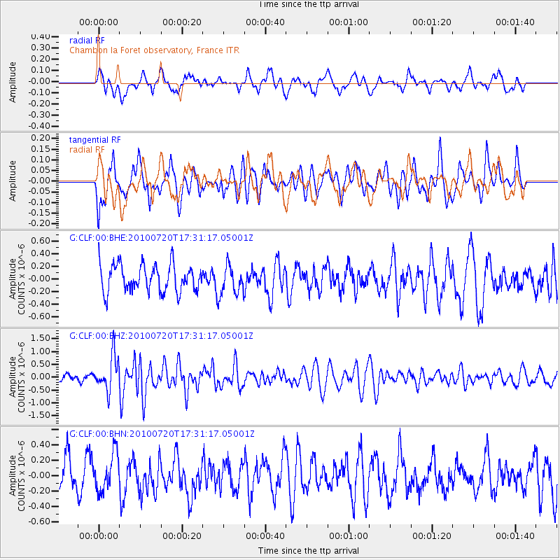
CLF Chambon la Foret observatory, France - Earthquake Result Viewer
*The percent match for this event was below the threshold and hence no stack was calculated.
| Earthquake location: |
Southern Mid-Atlantic Ridge |
| Earthquake latitude/longitude: |
-29.0/-13.1 |
| Earthquake time(UTC): |
2010/07/20 (201) 17:19:50 GMT |
| Earthquake Depth: |
10 km |
| Earthquake Magnitude: |
5.7 MB, 5.5 MS, 5.8 MW |
| Earthquake Catalog/Contributor: |
WHDF/NEIC |
|
| Network: |
G GEOSCOPE |
| Station: |
CLF Chambon la Foret observatory, France |
| Lat/Lon: |
48.03 N/2.26 E |
| Elevation: |
145 m |
|
| Distance: |
77.9 deg |
| Az: |
10.473 deg |
| Baz: |
193.718 deg |
| Ray Param: |
$rayparam |
*The percent match for this event was below the threshold and hence was not used in the summary stack. |
|
| Radial Match: |
50.511356 % |
| Radial Bump: |
400 |
| Transverse Match: |
54.738846 % |
| Transverse Bump: |
400 |
| SOD ConfigId: |
319893 |
| Insert Time: |
2011-01-05 08:44:12.738 +0000 |
| GWidth: |
2.5 |
| Max Bumps: |
400 |
| Tol: |
0.001 |
|
Signal To Noise
| Channel | StoN | STA | LTA |
| G:CLF:00:BHZ:20100720T17:31:17.05001Z | 4.18425 | 7.0131773E-7 | 1.6760895E-7 |
| G:CLF:00:BHN:20100720T17:31:17.05001Z | 1.114582 | 2.5048126E-7 | 2.2473114E-7 |
| G:CLF:00:BHE:20100720T17:31:17.05001Z | 1.0448276 | 2.2179341E-7 | 2.1227753E-7 |
| Arrivals |
| Ps | |
| PpPs | |
| PsPs/PpSs | |


