You are here: Home > Network List > GT - Global Telemetered Seismograph Network (USAF/USGS) Stations List
> Station LPAZ La Paz , Bolivia > Earthquake Result Viewer
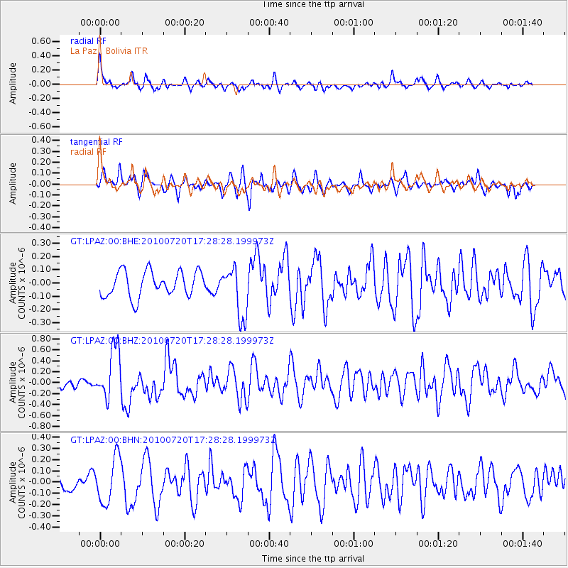
LPAZ La Paz , Bolivia - Earthquake Result Viewer
*The percent match for this event was below the threshold and hence no stack was calculated.
| Earthquake location: |
Southern Mid-Atlantic Ridge |
| Earthquake latitude/longitude: |
-29.0/-13.1 |
| Earthquake time(UTC): |
2010/07/20 (201) 17:19:50 GMT |
| Earthquake Depth: |
10 km |
| Earthquake Magnitude: |
5.7 MB, 5.5 MS, 5.8 MW |
| Earthquake Catalog/Contributor: |
WHDF/NEIC |
|
| Network: |
GT Global Telemetered Seismograph Network (USAF/USGS) |
| Station: |
LPAZ La Paz , Bolivia |
| Lat/Lon: |
16.17 S/68.08 W |
| Elevation: |
4817 m |
|
| Distance: |
51.9 deg |
| Az: |
271.732 deg |
| Baz: |
114.366 deg |
| Ray Param: |
$rayparam |
*The percent match for this event was below the threshold and hence was not used in the summary stack. |
|
| Radial Match: |
74.69755 % |
| Radial Bump: |
400 |
| Transverse Match: |
57.666386 % |
| Transverse Bump: |
400 |
| SOD ConfigId: |
319893 |
| Insert Time: |
2011-01-05 08:45:01.640 +0000 |
| GWidth: |
2.5 |
| Max Bumps: |
400 |
| Tol: |
0.001 |
|
Signal To Noise
| Channel | StoN | STA | LTA |
| GT:LPAZ:00:BHZ:20100720T17:28:28.199973Z | 5.8685946 | 4.818248E-7 | 8.2102254E-8 |
| GT:LPAZ:00:BHN:20100720T17:28:28.199973Z | 2.0579927 | 2.0801632E-7 | 1.0107728E-7 |
| GT:LPAZ:00:BHE:20100720T17:28:28.199973Z | 2.066025 | 1.9721716E-7 | 9.5457295E-8 |
| Arrivals |
| Ps | |
| PpPs | |
| PsPs/PpSs | |


