You are here: Home > Network List > GS - US Geological Survey Networks Stations List
> Station OK051 E0350 and S34600 roads, Ralston OK > Earthquake Result Viewer
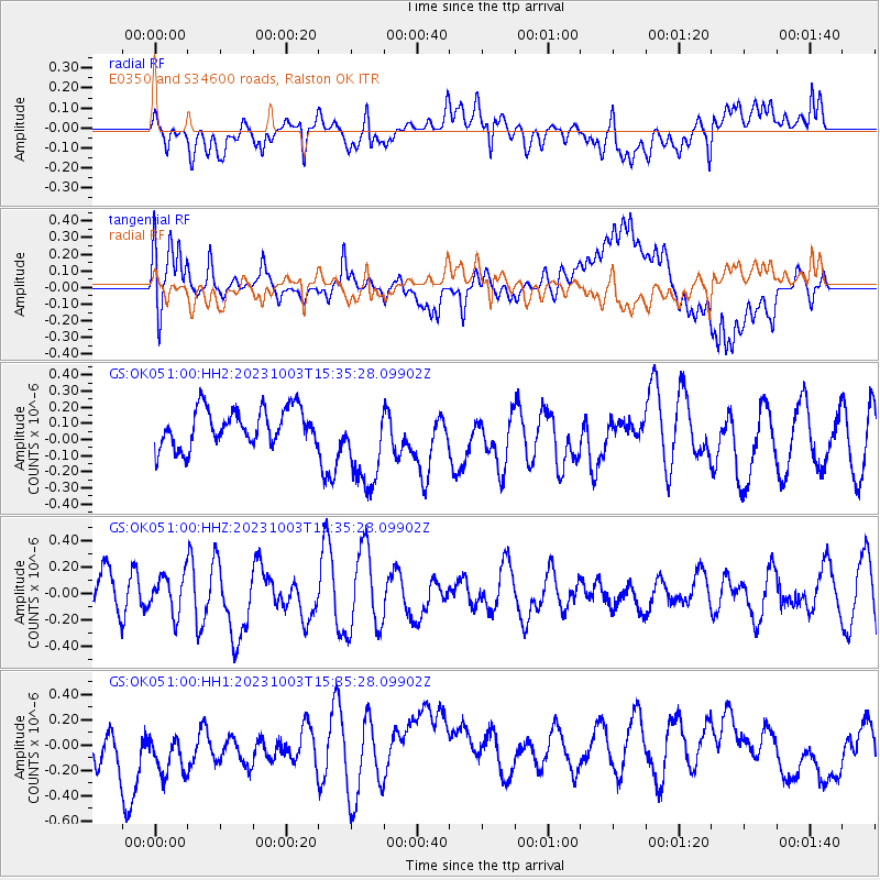
OK051 E0350 and S34600 roads, Ralston OK - Earthquake Result Viewer
*The percent match for this event was below the threshold and hence no stack was calculated.
| Earthquake location: |
Southeast Of Honshu, Japan |
| Earthquake latitude/longitude: |
29.9/140.1 |
| Earthquake time(UTC): |
2023/10/03 (276) 15:22:36 GMT |
| Earthquake Depth: |
10 km |
| Earthquake Magnitude: |
5.8 Mww |
| Earthquake Catalog/Contributor: |
NEIC PDE/us |
|
| Network: |
GS US Geological Survey Networks |
| Station: |
OK051 E0350 and S34600 roads, Ralston OK |
| Lat/Lon: |
36.50 N/96.84 W |
| Elevation: |
263 m |
|
| Distance: |
95.1 deg |
| Az: |
42.65 deg |
| Baz: |
313.105 deg |
| Ray Param: |
$rayparam |
*The percent match for this event was below the threshold and hence was not used in the summary stack. |
|
| Radial Match: |
62.014294 % |
| Radial Bump: |
400 |
| Transverse Match: |
62.845207 % |
| Transverse Bump: |
400 |
| SOD ConfigId: |
31937991 |
| Insert Time: |
2023-10-17 15:38:11.982 +0000 |
| GWidth: |
2.5 |
| Max Bumps: |
400 |
| Tol: |
0.001 |
|
Signal To Noise
| Channel | StoN | STA | LTA |
| GS:OK051:00:HHZ:20231003T15:35:28.09902Z | 0.6554915 | 1.4485818E-7 | 2.2099171E-7 |
| GS:OK051:00:HH1:20231003T15:35:28.09902Z | 1.6011869 | 2.7062015E-7 | 1.6901221E-7 |
| GS:OK051:00:HH2:20231003T15:35:28.09902Z | 2.4683902 | 2.8412416E-7 | 1.15105045E-7 |
| Arrivals |
| Ps | |
| PpPs | |
| PsPs/PpSs | |


