You are here: Home > Network List > US - United States National Seismic Network Stations List
> Station HAWA Hanford, Washington, USA > Earthquake Result Viewer
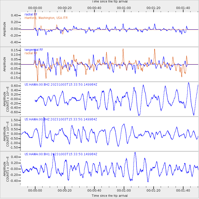
HAWA Hanford, Washington, USA - Earthquake Result Viewer
*The percent match for this event was below the threshold and hence no stack was calculated.
| Earthquake location: |
Southeast Of Honshu, Japan |
| Earthquake latitude/longitude: |
29.9/140.1 |
| Earthquake time(UTC): |
2023/10/03 (276) 15:22:36 GMT |
| Earthquake Depth: |
10 km |
| Earthquake Magnitude: |
5.8 Mww |
| Earthquake Catalog/Contributor: |
NEIC PDE/us |
|
| Network: |
US United States National Seismic Network |
| Station: |
HAWA Hanford, Washington, USA |
| Lat/Lon: |
46.39 N/119.53 W |
| Elevation: |
364 m |
|
| Distance: |
75.6 deg |
| Az: |
44.665 deg |
| Baz: |
298.137 deg |
| Ray Param: |
$rayparam |
*The percent match for this event was below the threshold and hence was not used in the summary stack. |
|
| Radial Match: |
57.223507 % |
| Radial Bump: |
378 |
| Transverse Match: |
59.267254 % |
| Transverse Bump: |
370 |
| SOD ConfigId: |
31937991 |
| Insert Time: |
2023-10-17 15:49:05.002 +0000 |
| GWidth: |
2.5 |
| Max Bumps: |
400 |
| Tol: |
0.001 |
|
Signal To Noise
| Channel | StoN | STA | LTA |
| US:HAWA:00:BHZ:20231003T15:33:50.149984Z | 3.0459945 | 6.8401914E-7 | 2.245635E-7 |
| US:HAWA:00:BH1:20231003T15:33:50.149984Z | 0.6142759 | 8.182939E-8 | 1.3321278E-7 |
| US:HAWA:00:BH2:20231003T15:33:50.149984Z | 1.3980454 | 2.1477322E-7 | 1.5362393E-7 |
| Arrivals |
| Ps | |
| PpPs | |
| PsPs/PpSs | |


