You are here: Home > Network List > US - United States National Seismic Network Stations List
> Station MNTX Cornudas Mountains, Texas, USA > Earthquake Result Viewer
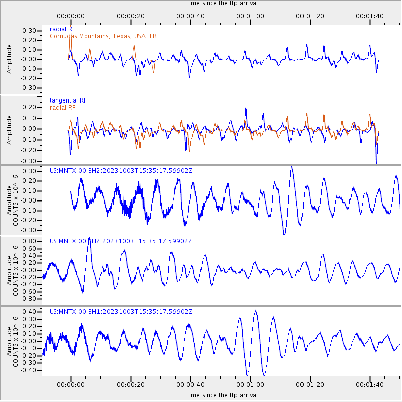
MNTX Cornudas Mountains, Texas, USA - Earthquake Result Viewer
*The percent match for this event was below the threshold and hence no stack was calculated.
| Earthquake location: |
Southeast Of Honshu, Japan |
| Earthquake latitude/longitude: |
29.9/140.1 |
| Earthquake time(UTC): |
2023/10/03 (276) 15:22:36 GMT |
| Earthquake Depth: |
10 km |
| Earthquake Magnitude: |
5.8 Mww |
| Earthquake Catalog/Contributor: |
NEIC PDE/us |
|
| Network: |
US United States National Seismic Network |
| Station: |
MNTX Cornudas Mountains, Texas, USA |
| Lat/Lon: |
31.70 N/105.38 W |
| Elevation: |
405 m |
|
| Distance: |
92.8 deg |
| Az: |
50.91 deg |
| Baz: |
307.76 deg |
| Ray Param: |
$rayparam |
*The percent match for this event was below the threshold and hence was not used in the summary stack. |
|
| Radial Match: |
62.71556 % |
| Radial Bump: |
400 |
| Transverse Match: |
69.2732 % |
| Transverse Bump: |
400 |
| SOD ConfigId: |
31937991 |
| Insert Time: |
2023-10-17 15:49:14.331 +0000 |
| GWidth: |
2.5 |
| Max Bumps: |
400 |
| Tol: |
0.001 |
|
Signal To Noise
| Channel | StoN | STA | LTA |
| US:MNTX:00:BHZ:20231003T15:35:17.59902Z | 1.7612545 | 2.905101E-7 | 1.6494496E-7 |
| US:MNTX:00:BH1:20231003T15:35:17.59902Z | 1.1850178 | 1.2873353E-7 | 1.08634254E-7 |
| US:MNTX:00:BH2:20231003T15:35:17.59902Z | 1.380521 | 1.2287968E-7 | 8.9009646E-8 |
| Arrivals |
| Ps | |
| PpPs | |
| PsPs/PpSs | |


