You are here: Home > Network List > TA - USArray Transportable Network (new EarthScope stations) Stations List
> Station L02D Cave Junction, OR, USA > Earthquake Result Viewer
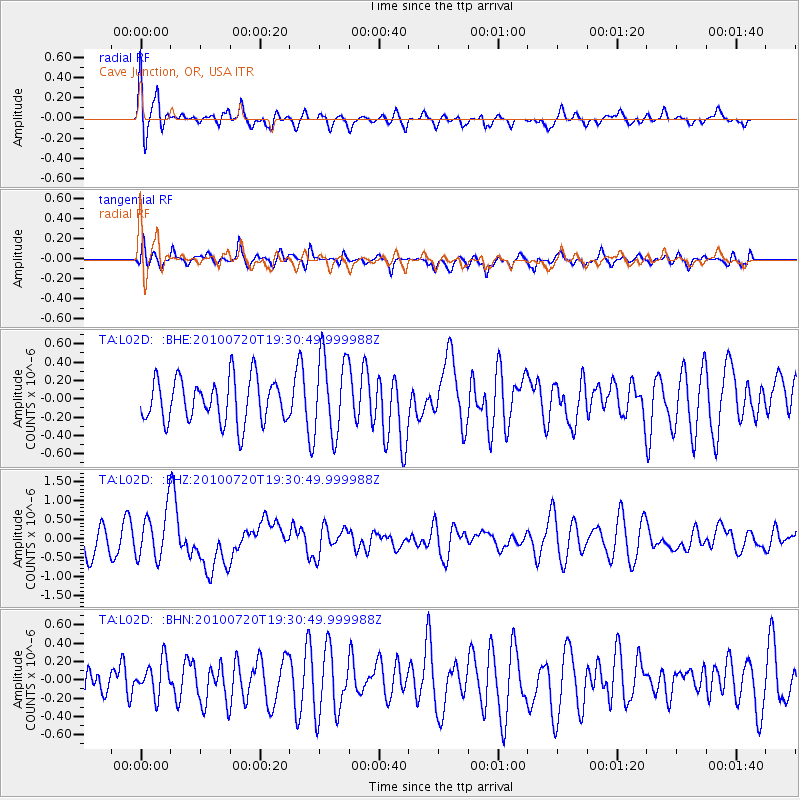
L02D Cave Junction, OR, USA - Earthquake Result Viewer
*The percent match for this event was below the threshold and hence no stack was calculated.
| Earthquake location: |
New Britain Region, P.N.G. |
| Earthquake latitude/longitude: |
-5.9/150.7 |
| Earthquake time(UTC): |
2010/07/20 (201) 19:18:21 GMT |
| Earthquake Depth: |
35 km |
| Earthquake Magnitude: |
5.6 MB, 6.3 MS, 6.3 MW, 6.3 MW |
| Earthquake Catalog/Contributor: |
WHDF/NEIC |
|
| Network: |
TA USArray Transportable Network (new EarthScope stations) |
| Station: |
L02D Cave Junction, OR, USA |
| Lat/Lon: |
42.16 N/123.60 W |
| Elevation: |
458 m |
|
| Distance: |
90.7 deg |
| Az: |
47.859 deg |
| Baz: |
262.759 deg |
| Ray Param: |
$rayparam |
*The percent match for this event was below the threshold and hence was not used in the summary stack. |
|
| Radial Match: |
69.39649 % |
| Radial Bump: |
400 |
| Transverse Match: |
51.886543 % |
| Transverse Bump: |
400 |
| SOD ConfigId: |
319893 |
| Insert Time: |
2011-01-05 08:57:02.258 +0000 |
| GWidth: |
2.5 |
| Max Bumps: |
400 |
| Tol: |
0.001 |
|
Signal To Noise
| Channel | StoN | STA | LTA |
| TA:L02D: :BHZ:20100720T19:30:49.999988Z | 1.9283779 | 6.389813E-7 | 3.3135692E-7 |
| TA:L02D: :BHN:20100720T19:30:49.999988Z | 0.8909945 | 1.875196E-7 | 2.1046102E-7 |
| TA:L02D: :BHE:20100720T19:30:49.999988Z | 1.8523583 | 4.3823636E-7 | 2.3658292E-7 |
| Arrivals |
| Ps | |
| PpPs | |
| PsPs/PpSs | |


