You are here: Home > Network List > UW - Pacific Northwest Regional Seismic Network Stations List
> Station UMAT Pilot Rock, OR, USA > Earthquake Result Viewer
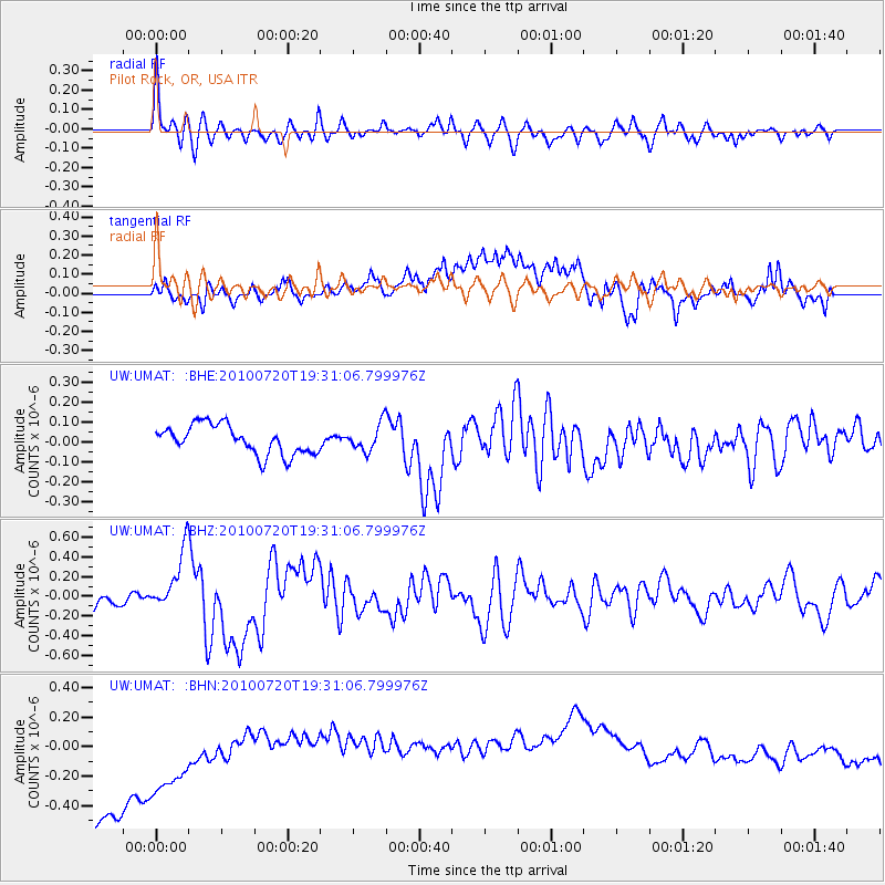
UMAT Pilot Rock, OR, USA - Earthquake Result Viewer
*The percent match for this event was below the threshold and hence no stack was calculated.
| Earthquake location: |
New Britain Region, P.N.G. |
| Earthquake latitude/longitude: |
-5.9/150.7 |
| Earthquake time(UTC): |
2010/07/20 (201) 19:18:21 GMT |
| Earthquake Depth: |
35 km |
| Earthquake Magnitude: |
5.6 MB, 6.3 MS, 6.3 MW, 6.3 MW |
| Earthquake Catalog/Contributor: |
WHDF/NEIC |
|
| Network: |
UW Pacific Northwest Regional Seismic Network |
| Station: |
UMAT Pilot Rock, OR, USA |
| Lat/Lon: |
45.29 N/118.96 W |
| Elevation: |
1318 m |
|
| Distance: |
94.4 deg |
| Az: |
45.07 deg |
| Baz: |
266.084 deg |
| Ray Param: |
$rayparam |
*The percent match for this event was below the threshold and hence was not used in the summary stack. |
|
| Radial Match: |
61.230347 % |
| Radial Bump: |
400 |
| Transverse Match: |
6.850483 % |
| Transverse Bump: |
400 |
| SOD ConfigId: |
319893 |
| Insert Time: |
2011-01-05 08:58:37.916 +0000 |
| GWidth: |
2.5 |
| Max Bumps: |
400 |
| Tol: |
0.001 |
|
Signal To Noise
| Channel | StoN | STA | LTA |
| UW:UMAT: :BHZ:20100720T19:31:06.799976Z | 3.8047638 | 2.9959708E-7 | 7.874262E-8 |
| UW:UMAT: :BHN:20100720T19:31:06.799976Z | 0.7631653 | 6.08542E-7 | 7.9739215E-7 |
| UW:UMAT: :BHE:20100720T19:31:06.799976Z | 0.92810833 | 6.772248E-8 | 7.296829E-8 |
| Arrivals |
| Ps | |
| PpPs | |
| PsPs/PpSs | |


