You are here: Home > Network List > US - United States National Seismic Network Stations List
> Station EGMT Eagleton, Montana, USA > Earthquake Result Viewer
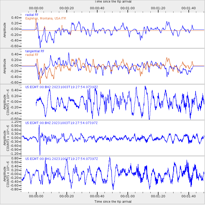
EGMT Eagleton, Montana, USA - Earthquake Result Viewer
*The percent match for this event was below the threshold and hence no stack was calculated.
| Earthquake location: |
Bonin Islands, Japan Region |
| Earthquake latitude/longitude: |
28.4/138.8 |
| Earthquake time(UTC): |
2023/10/03 (276) 19:16:58 GMT |
| Earthquake Depth: |
517 km |
| Earthquake Magnitude: |
5.3 Mww |
| Earthquake Catalog/Contributor: |
NEIC PDE/us |
|
| Network: |
US United States National Seismic Network |
| Station: |
EGMT Eagleton, Montana, USA |
| Lat/Lon: |
48.02 N/109.75 W |
| Elevation: |
1055 m |
|
| Distance: |
82.3 deg |
| Az: |
39.081 deg |
| Baz: |
304.153 deg |
| Ray Param: |
$rayparam |
*The percent match for this event was below the threshold and hence was not used in the summary stack. |
|
| Radial Match: |
43.121845 % |
| Radial Bump: |
400 |
| Transverse Match: |
49.892227 % |
| Transverse Bump: |
400 |
| SOD ConfigId: |
31937991 |
| Insert Time: |
2023-10-17 19:40:24.832 +0000 |
| GWidth: |
2.5 |
| Max Bumps: |
400 |
| Tol: |
0.001 |
|
Signal To Noise
| Channel | StoN | STA | LTA |
| US:EGMT:00:BHZ:20231003T19:27:54.07397Z | 2.9046996 | 3.9312832E-7 | 1.3534216E-7 |
| US:EGMT:00:BH1:20231003T19:27:54.07397Z | 1.5022155 | 2.810374E-7 | 1.8708194E-7 |
| US:EGMT:00:BH2:20231003T19:27:54.07397Z | 1.0482824 | 2.0116687E-7 | 1.9190139E-7 |
| Arrivals |
| Ps | |
| PpPs | |
| PsPs/PpSs | |


