You are here: Home > Network List > II - Global Seismograph Network (GSN - IRIS/IDA) Stations List
> Station ABKT Alibek, Turkmenistan > Earthquake Result Viewer
ABKT Alibek, Turkmenistan - Earthquake Result Viewer

| Earthquake location: |
North Of Halmahera, Indonesia |
| Earthquake latitude/longitude: |
3.0/128.2 |
| Earthquake time(UTC): |
2010/07/21 (202) 09:16:04 GMT |
| Earthquake Depth: |
100 km |
| Earthquake Magnitude: |
6.0 MB, 6.1 MW, 6.1 MW |
| Earthquake Catalog/Contributor: |
WHDF/NEIC |
|
| Network: |
II Global Seismograph Network (GSN - IRIS/IDA) |
| Station: |
ABKT Alibek, Turkmenistan |
| Lat/Lon: |
37.93 N/58.12 E |
| Elevation: |
678 m |
|
| Distance: |
72.5 deg |
| Az: |
308.766 deg |
| Baz: |
100.049 deg |
| Ray Param: |
0.053391255 |
| Estimated Moho Depth: |
20.25 km |
| Estimated Crust Vp/Vs: |
2.10 |
| Assumed Crust Vp: |
6.53 km/s |
| Estimated Crust Vs: |
3.113 km/s |
| Estimated Crust Poisson's Ratio: |
0.35 |
|
| Radial Match: |
94.506584 % |
| Radial Bump: |
400 |
| Transverse Match: |
90.77975 % |
| Transverse Bump: |
400 |
| SOD ConfigId: |
319893 |
| Insert Time: |
2011-01-05 09:14:19.139 +0000 |
| GWidth: |
2.5 |
| Max Bumps: |
400 |
| Tol: |
0.001 |
|
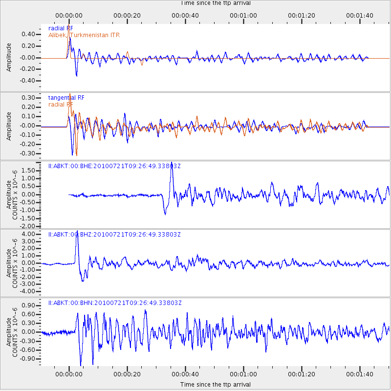
Signal To Noise
| Channel | StoN | STA | LTA |
| II:ABKT:00:BHZ:20100721T09:26:49.33803Z | 26.806004 | 1.80948E-6 | 6.750279E-8 |
| II:ABKT:00:BHN:20100721T09:26:49.33803Z | 8.524529 | 3.9786525E-7 | 4.6672987E-8 |
| II:ABKT:00:BHE:20100721T09:26:49.33803Z | 12.664387 | 5.020752E-7 | 3.964465E-8 |
| Arrivals |
| Ps | 3.5 SECOND |
| PpPs | 9.3 SECOND |
| PsPs/PpSs | 13 SECOND |


