You are here: Home > Network List > AV - Alaska Volcano Observatory Stations List
> Station MAPS Pakushin Southeast, Makushin Volcano, Alaska > Earthquake Result Viewer
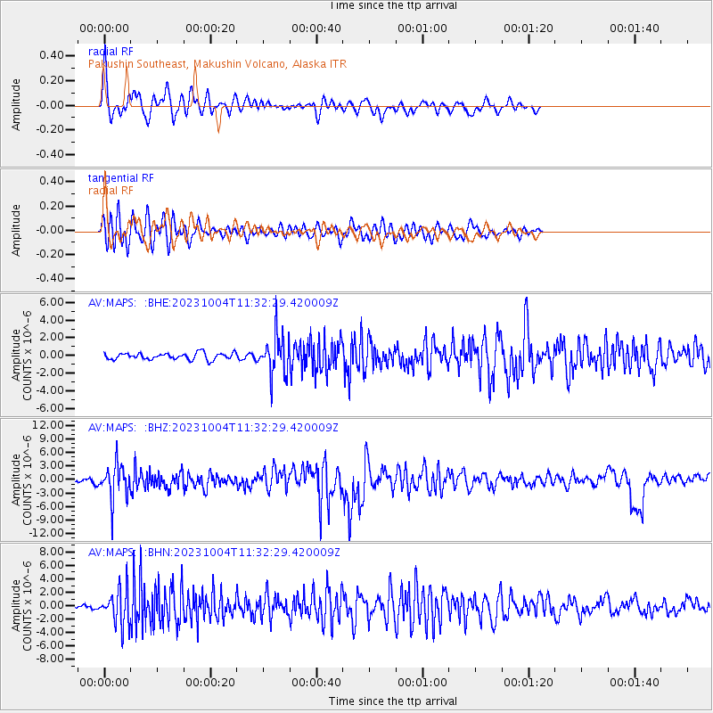
MAPS Pakushin Southeast, Makushin Volcano, Alaska - Earthquake Result Viewer
*The percent match for this event was below the threshold and hence no stack was calculated.
| Earthquake location: |
Mindanao, Philippines |
| Earthquake latitude/longitude: |
5.3/126.1 |
| Earthquake time(UTC): |
2023/10/04 (277) 11:21:48 GMT |
| Earthquake Depth: |
122 km |
| Earthquake Magnitude: |
6.4 mww |
| Earthquake Catalog/Contributor: |
NEIC PDE/us |
|
| Network: |
AV Alaska Volcano Observatory |
| Station: |
MAPS Pakushin Southeast, Makushin Volcano, Alaska |
| Lat/Lon: |
53.81 N/166.94 W |
| Elevation: |
333 m |
|
| Distance: |
72.2 deg |
| Az: |
34.979 deg |
| Baz: |
254.255 deg |
| Ray Param: |
$rayparam |
*The percent match for this event was below the threshold and hence was not used in the summary stack. |
|
| Radial Match: |
79.287025 % |
| Radial Bump: |
400 |
| Transverse Match: |
74.65489 % |
| Transverse Bump: |
400 |
| SOD ConfigId: |
31937991 |
| Insert Time: |
2023-10-18 11:31:56.028 +0000 |
| GWidth: |
2.5 |
| Max Bumps: |
400 |
| Tol: |
0.001 |
|
Signal To Noise
| Channel | StoN | STA | LTA |
| AV:MAPS: :BHZ:20231004T11:32:29.420009Z | 8.366053 | 3.7927898E-6 | 4.5335477E-7 |
| AV:MAPS: :BHN:20231004T11:32:29.420009Z | 7.083598 | 2.6428556E-6 | 3.7309508E-7 |
| AV:MAPS: :BHE:20231004T11:32:29.420009Z | 5.9828067 | 2.2295383E-6 | 3.7265758E-7 |
| Arrivals |
| Ps | |
| PpPs | |
| PsPs/PpSs | |


