You are here: Home > Network List > TA - USArray Transportable Network (new EarthScope stations) Stations List
> Station F22A Rosebud, MT, USA > Earthquake Result Viewer
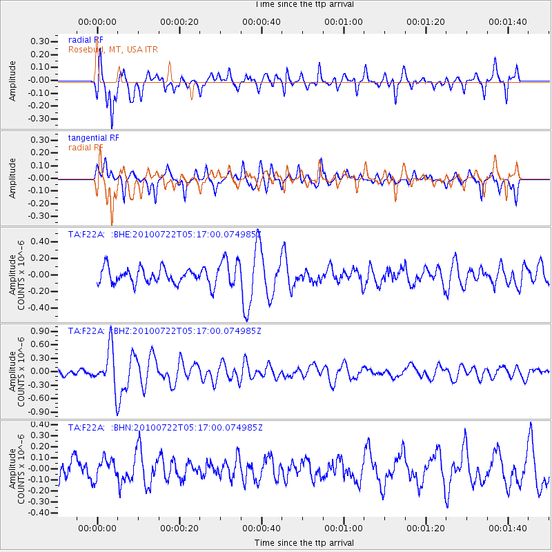
F22A Rosebud, MT, USA - Earthquake Result Viewer
*The percent match for this event was below the threshold and hence no stack was calculated.
| Earthquake location: |
Vanuatu Islands |
| Earthquake latitude/longitude: |
-15.1/168.2 |
| Earthquake time(UTC): |
2010/07/22 (203) 05:03:57 GMT |
| Earthquake Depth: |
10 km |
| Earthquake Magnitude: |
6.2 MB, 5.4 MS, 6.1 MW, 5.9 MW |
| Earthquake Catalog/Contributor: |
WHDF/NEIC |
|
| Network: |
TA USArray Transportable Network (new EarthScope stations) |
| Station: |
F22A Rosebud, MT, USA |
| Lat/Lon: |
45.78 N/106.26 W |
| Elevation: |
882 m |
|
| Distance: |
97.7 deg |
| Az: |
44.751 deg |
| Baz: |
256.286 deg |
| Ray Param: |
$rayparam |
*The percent match for this event was below the threshold and hence was not used in the summary stack. |
|
| Radial Match: |
67.8388 % |
| Radial Bump: |
397 |
| Transverse Match: |
55.058876 % |
| Transverse Bump: |
332 |
| SOD ConfigId: |
319893 |
| Insert Time: |
2011-01-05 09:35:33.695 +0000 |
| GWidth: |
2.5 |
| Max Bumps: |
400 |
| Tol: |
0.001 |
|
Signal To Noise
| Channel | StoN | STA | LTA |
| TA:F22A: :BHZ:20100722T05:17:00.074985Z | 5.4692254 | 4.6365332E-7 | 8.4774946E-8 |
| TA:F22A: :BHN:20100722T05:17:00.074985Z | 0.54529023 | 9.072295E-8 | 1.6637551E-7 |
| TA:F22A: :BHE:20100722T05:17:00.074985Z | 1.8835611 | 1.6362445E-7 | 8.686973E-8 |
| Arrivals |
| Ps | |
| PpPs | |
| PsPs/PpSs | |


